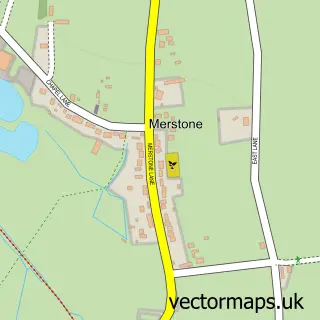
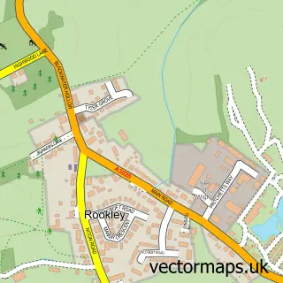
This Newchurch street map is a detailed vector street map covering a 750m x 750m area. Select a larger area to create and download your own vector street map of Newchurch.
The 750-metre map sample for Newchurch covers 144 mapped buildings and approximately 5.2 km of road detail, of which 8 named roads are named. The immediate area includes 1 school, 1 pub and 4 MOT stations within 2 miles. The wider area around Newchurch features 1 food and drink venue, 1 hotel and 4 campsites within 2 miles. To create a larger or custom map of Newchurch, the map builder lets you define your own coverage area and download editable SVG, PDF and PNG files.
Create a larger editable map of Newchurch
Choose any area you need and generate a high-quality vector map instantly. Perfect for print, planning, design, business and personal use.

This Newchurch street map in Isle of Wight is available as downloadable SVG, PDF and PNG map files, or as a printed map for planning, business, display, education, local information and design work. You can also create a larger custom map area using the map selector.
What this Newchurch map sample shows
Newchurch lies within Newchurch Cp parish, part of Arreton And Newchurch ward in the Isle Of Wight local authority area. The postcode geography for this area includes the PO postcode area, the PO36 postcode district and the PO36 0 postcode sector. Residents fall under the Nhs Hampshire And Isle Of Wight Integrated Care Board for NHS services.
Local features near Newchurch
Within 2 milesAmenities and services in and around Newchurch.
Administrative and postcode information for Newchurch
Newchurch lies within Newchurch Cp parish, part of Arreton And Newchurch ward in the Isle Of Wight local authority area. The postcode geography for this area includes the PO postcode area, the PO36 postcode district and the PO36 0 postcode sector. Residents fall under the Nhs Hampshire And Isle Of Wight Integrated Care Board for NHS services.
Nearby street map samples around Newchurch

More street maps in Isle of Wight
750 metre map area coverage
Boundary, postcode and point of interest information for the 750m x 750m rectangle centred on this sample map.
Boundaries containing map centre
Constituency: Isle of Wight East Co Const
District: Isle of Wight
Icb: NHS Hampshire and Isle of Wight ICB
Parish: Newchurch CP
Police Force: hampshire
Postcode District: PO36
Postcode Sector: PO36 0
Nearby boundaries intersecting sample
No additional intersecting boundaries found.
Postcode coverage
POI category counts
Butcher Shop: 1
Church Cathedral: 1
Elementary School: 1
Emergency Roadside Service: 1
Environmental Conservation Organization: 1
Hotel: 1
Post Office: 1
Pub: 1
Scout Hall: 1
Smoothie Juice Bar: 1
Sample points of interest
- Newchurch Poultry
- All Saints Church
- Newchurch Primary School
- Isle of Wight Recovery
- Martin's Wood Nature Reserve
- Springfields' Cottage
- Newchurch Post Office
- The Pointer Inn
- 1st Newchurch
- Made by Krista
Create a larger editable map of Newchurch
This sample shows only a 750 metre area. To create a larger map of Newchurch, use our map builder to choose your own coverage area, add titles and download editable SVG, PDF and PNG files.
Create a custom map of Newchurch