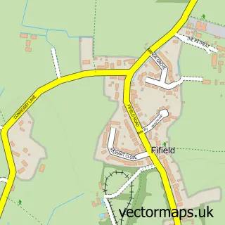
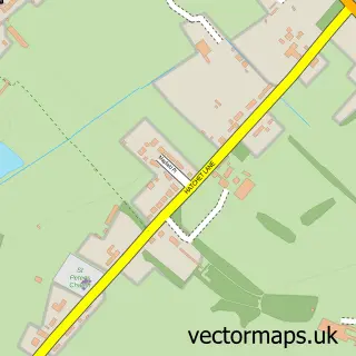
This Oakley Green street map is a detailed vector street map covering a 750m x 750m area. Select a larger area to create and download your own vector street map of Oakley Green.
The 750-metre map sample for Oakley Green covers 116 mapped buildings and approximately 5.9 km of road detail, of which 4 named roads are named. The immediate area includes 2 MOT stations within 2 miles. The wider area around Oakley Green features 2 tourism points of interest. To create a larger or custom map of Oakley Green, the map builder lets you define your own coverage area and download editable SVG, PDF and PNG files.
Create a larger editable map of Oakley Green
Choose any area you need and generate a high-quality vector map instantly. Perfect for print, planning, design, business and personal use.

This Oakley Green street map in Berkshire is available as downloadable SVG, PDF and PNG map files, or as a printed map for planning, business, display, education, local information and design work. You can also create a larger custom map area using the map selector.
What this Oakley Green map sample shows
Oakley Green lies within Bray Cp parish, part of Bray ward in the Windsor And Maidenhead (B) local authority area. The postcode geography for this area includes the SL postcode area, the SL4 postcode district and the SL4 4 postcode sector. Residents fall under the Nhs Frimley Integrated Care Board for NHS services.
Local features near Oakley Green
Within 2 milesAmenities and services in and around Oakley Green.
Administrative and postcode information for Oakley Green
Oakley Green lies within Bray Cp parish, part of Bray ward in the Windsor And Maidenhead (B) local authority area. The postcode geography for this area includes the SL postcode area, the SL4 postcode district and the SL4 4 postcode sector. Residents fall under the Nhs Frimley Integrated Care Board for NHS services.
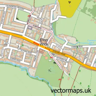
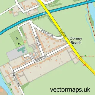
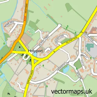
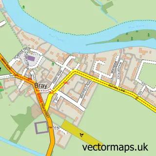
Nearby street map samples around Oakley Green

More street maps in Berkshire
750 metre map area coverage
Boundary, postcode and point of interest information for the 750m x 750m rectangle centred on this sample map.
Boundaries containing map centre
Constituency: Maidenhead Co Const
District: Windsor and Maidenhead (B)
Icb: NHS Frimley ICB
Parish: Bray CP
Police Force: thames valley
Postcode District: SL4
Postcode Sector: SL4 5
Ward: Bray Ward
Nearby boundaries intersecting sample
Constituency: Windsor Co Const
Postcode Sector: SL4 4
Ward: Clewer & Dedworth West Ward
Postcode coverage
POI category counts
Automotive Repair: 1
Bed And Breakfast: 1
Building Supply Store: 1
Cleaning Services: 1
Corporate Entertainment Services: 1
Counseling And Mental Health: 1
Event Planning: 1
Furniture Store: 1
Gastropub: 1
Hair Salon: 1
Sample points of interest
- Shedtune
- The Old Farmhouse
- Willow Waste
- Oakley Environmental
- EGI Live
- Cardinal Clinic
- Saxons Barn
- Rugs 4 U
- The Greene Oak
- Sally Howie Hair
- Cardinal Clinic
- Maxim Gb
Create a larger editable map of Oakley Green
This sample shows only a 750 metre area. To create a larger map of Oakley Green, use our map builder to choose your own coverage area, add titles and download editable SVG, PDF and PNG files.
Create a custom map of Oakley Green