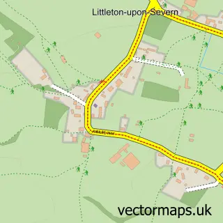
This Oldbury on Severn street map is a detailed vector street map covering a 750m x 750m area. Select a larger area to create and download your own vector street map of Oldbury on Severn.
The 750-metre map sample for Oldbury on Severn covers 174 mapped buildings and approximately 7.9 km of road detail, of which 8 named roads are named. The immediate area includes 2 pubs. The wider area around Oldbury on Severn features 2 food and drink venues. To create a larger or custom map of Oldbury on Severn, the map builder lets you define your own coverage area and download editable SVG, PDF and PNG files.
Create a larger editable map of Oldbury on Severn
Choose any area you need and generate a high-quality vector map instantly. Perfect for print, planning, design, business and personal use.

This Oldbury on Severn street map in Gloucestershire is available as downloadable SVG, PDF and PNG map files, or as a printed map for planning, business, display, education, local information and design work. You can also create a larger custom map area using the map selector.
What this Oldbury on Severn map sample shows
Oldbury on Severn lies within Oldbury-Upon-Severn Cp parish, part of Severn Vale ward in the South Gloucestershire local authority area. The postcode geography for this area includes the BS postcode area, the BS35 postcode district and the BS35 1 postcode sector. Residents fall under the Nhs Bristol, North Somerset And South Gloucestershire Integrated Care Board for NHS services.
Local features near Oldbury on Severn
Within 2 milesAmenities and services in and around Oldbury on Severn.
Administrative and postcode information for Oldbury on Severn
Oldbury on Severn lies within Oldbury-Upon-Severn Cp parish, part of Severn Vale ward in the South Gloucestershire local authority area. The postcode geography for this area includes the BS postcode area, the BS35 postcode district and the BS35 1 postcode sector. Residents fall under the Nhs Bristol, North Somerset And South Gloucestershire Integrated Care Board for NHS services.
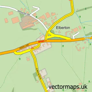
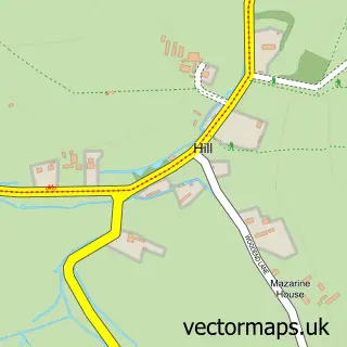
Nearby street map samples around Oldbury on Severn


More street maps in Gloucestershire
750 metre map area coverage
Boundary, postcode and point of interest information for the 750m x 750m rectangle centred on this sample map.
Boundaries containing map centre
Constituency: Thornbury and Yate Co Const
District: South Gloucestershire
Icb: NHS Bristol North Somerset and South Gloucestershire ICB
Parish: Oldbury-upon-Severn CP
Police Force: avon and somerset
Postcode District: BS35
Postcode Sector: BS35 1
Ward: Severn Vale Ward
Nearby boundaries intersecting sample
No additional intersecting boundaries found.
Postcode coverage
POI category counts
Pub: 2
Bar: 1
Community Services Non Profits: 1
Contractor: 1
Education: 1
Preschool: 1
Sample points of interest
- Hooch’s Hut
- The Beehive Oldbury on Severn Baby and Toddler group
- Richards Tiling Services
- RPM Associates
- Oldbury Busy Bees Playgroup & Pre School
- The Anchor Inn
- The Ship Inn
Create a larger editable map of Oldbury on Severn
This sample shows only a 750 metre area. To create a larger map of Oldbury on Severn, use our map builder to choose your own coverage area, add titles and download editable SVG, PDF and PNG files.
Create a custom map of Oldbury on Severn