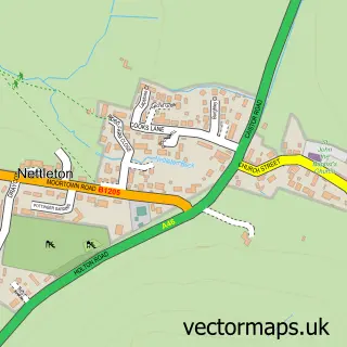
This Osgodby street map is a detailed vector street map covering a 750m x 750m area. Select a larger area to create and download your own vector street map of Osgodby.
The 750-metre map sample for Osgodby covers 142 mapped buildings and approximately 5.0 km of road detail, of which 4 named roads are named. The immediate area includes 1 school. The wider area around Osgodby features 1 campsite within 2 miles. To create a larger or custom map of Osgodby, the map builder lets you define your own coverage area and download editable SVG, PDF and PNG files.
Create a larger editable map of Osgodby
Choose any area you need and generate a high-quality vector map instantly. Perfect for print, planning, design, business and personal use.

This Osgodby street map in Lincolnshire is available as downloadable SVG, PDF and PNG map files, or as a printed map for planning, business, display, education, local information and design work. You can also create a larger custom map area using the map selector.
What this Osgodby map sample shows
Osgodby lies within Osgodby Cp parish, part of Market Rasen ward in the West Lindsey District local authority area. The postcode geography for this area includes the LN postcode area, the LN8 postcode district and the LN8 3 postcode sector. Residents fall under the Nhs Lincolnshire Integrated Care Board for NHS services.
Local features near Osgodby
Within 2 milesAmenities and services in and around Osgodby.
Administrative and postcode information for Osgodby
Osgodby lies within Osgodby Cp parish, part of Market Rasen ward in the West Lindsey District local authority area. The postcode geography for this area includes the LN postcode area, the LN8 postcode district and the LN8 3 postcode sector. Residents fall under the Nhs Lincolnshire Integrated Care Board for NHS services.
Nearby street map samples around Osgodby

More street maps in Lincolnshire
750 metre map area coverage
Boundary, postcode and point of interest information for the 750m x 750m rectangle centred on this sample map.
Boundaries containing map centre
Constituency: Gainsborough Co Const
County: Lincolnshire County
District: West Lindsey District
Icb: NHS Lincolnshire ICB
Parish: Osgodby CP
Police Force: lincolnshire
Postcode District: LN8
Postcode Sector: LN8 3
Ward: Market Rasen Ward
Nearby boundaries intersecting sample
Parish: Owersby CP
Postcode coverage
POI category counts
Shipping Center: 2
Art Restoration: 1
Elementary School: 1
Flowers And Gifts Shop: 1
Home Service: 1
Post Office: 1
Sample points of interest
- Lisa Hawkins Ceramics and Glassware Repair
- Osgodby Primary School
- Owersby Bridge Honey Farm
- Pegasus Childcare Centre
- Osgodby Post Office
- Osgodby Post Office
- Post Office-Osgodby
Create a larger editable map of Osgodby
This sample shows only a 750 metre area. To create a larger map of Osgodby, use our map builder to choose your own coverage area, add titles and download editable SVG, PDF and PNG files.
Create a custom map of Osgodby