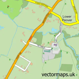
This Over Peover street map is a detailed vector street map covering a 750m x 750m area. Select a larger area to create and download your own vector street map of Over Peover.
The 750-metre map sample for Over Peover covers 93 mapped buildings and approximately 6.2 km of road detail, of which 8 named roads are named. The immediate area includes 1 school, 1 GP surgery within 2 miles and 1 pub. The wider area around Over Peover features 1 tourism point of interest and 1 food and drink venue. To create a larger or custom map of Over Peover, the map builder lets you define your own coverage area and download editable SVG, PDF and PNG files.
Create a larger editable map of Over Peover
Choose any area you need and generate a high-quality vector map instantly. Perfect for print, planning, design, business and personal use.

This Over Peover street map in Cheshire is available as downloadable SVG, PDF and PNG map files, or as a printed map for planning, business, display, education, local information and design work. You can also create a larger custom map area using the map selector.
What this Over Peover map sample shows
Over Peover lies within Peover Superior And Snelson Cp parish, part of Chelford ward in the Cheshire East (B) local authority area. The postcode geography for this area includes the WA postcode area, the WA16 postcode district and the WA16 8 postcode sector. Residents fall under the Nhs Cheshire And Merseyside Integrated Care Board for NHS services.
Local features near Over Peover
Within 2 milesAmenities and services in and around Over Peover.
Administrative and postcode information for Over Peover
Over Peover lies within Peover Superior And Snelson Cp parish, part of Chelford ward in the Cheshire East (B) local authority area. The postcode geography for this area includes the WA postcode area, the WA16 postcode district and the WA16 8 postcode sector. Residents fall under the Nhs Cheshire And Merseyside Integrated Care Board for NHS services.
Nearby street map samples around Over Peover

More street maps in Cheshire
750 metre map area coverage
Boundary, postcode and point of interest information for the 750m x 750m rectangle centred on this sample map.
Boundaries containing map centre
Constituency: Tatton Co Const
District: Cheshire East (B)
Icb: NHS Cheshire and Merseyside ICB
Parish: Peover Superior and Snelson CP
Police Force: cheshire
Postcode District: WA16
Postcode Sector: WA16 8
Ward: Chelford Ward
Nearby boundaries intersecting sample
Postcode Sector: WA16 9
Postcode coverage
POI category counts
Chimney Sweep: 2
Agricultural Service: 1
Cricket Ground: 1
Elementary School: 1
Employment Agencies: 1
Glass And Mirror Sales Service: 1
Gym: 1
Park: 1
Pub: 1
Sample points of interest
- Dales Agri
- R & S Bagnall
- R Bagnall
- Over Peover Cricket Club
- Peover Superior Endowed Primary School
- Mint Recruitment
- Knutsford Stained Glass
- Colshaw Hall
- Peover Park
- Park Gate Inn
Create a larger editable map of Over Peover
This sample shows only a 750 metre area. To create a larger map of Over Peover, use our map builder to choose your own coverage area, add titles and download editable SVG, PDF and PNG files.
Create a custom map of Over Peover