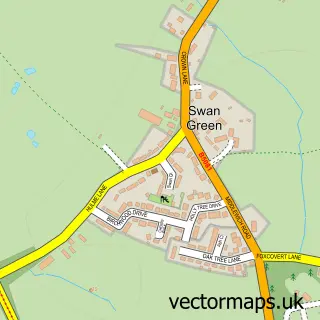
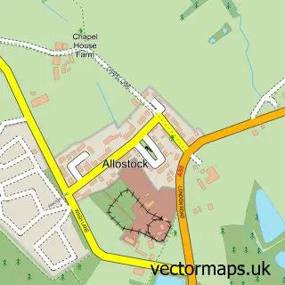
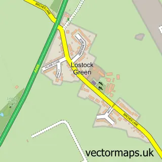
This Lower Peover street map is a detailed vector street map covering a 750m x 750m area. Select a larger area to create and download your own vector street map of Lower Peover.
The 750-metre map sample for Lower Peover covers 67 mapped buildings and approximately 6.5 km of road detail, of which 8 named roads are named. The immediate area includes 1 school, 1 pub and 1 MOT station within 2 miles. The wider area around Lower Peover features 1 tourism point of interest and 2 food and drink venues. To create a larger or custom map of Lower Peover, the map builder lets you define your own coverage area and download editable SVG, PDF and PNG files.
Create a larger editable map of Lower Peover
Choose any area you need and generate a high-quality vector map instantly. Perfect for print, planning, design, business and personal use.

This Lower Peover street map in Cheshire is available as downloadable SVG, PDF and PNG map files, or as a printed map for planning, business, display, education, local information and design work. You can also create a larger custom map area using the map selector.
What this Lower Peover map sample shows
Lower Peover lies within Peover Inferior Cp parish, part of Chelford ward in the Cheshire East (B) local authority area. The postcode geography for this area includes the WA postcode area, the WA16 postcode district and the WA16 9 postcode sector. Residents fall under the Nhs Cheshire And Merseyside Integrated Care Board for NHS services.
Local features near Lower Peover
Within 2 milesAmenities and services in and around Lower Peover.
Administrative and postcode information for Lower Peover
Lower Peover lies within Peover Inferior Cp parish, part of Chelford ward in the Cheshire East (B) local authority area. The postcode geography for this area includes the WA postcode area, the WA16 postcode district and the WA16 9 postcode sector. Residents fall under the Nhs Cheshire And Merseyside Integrated Care Board for NHS services.
Nearby street map samples around Lower Peover

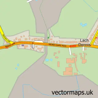
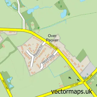
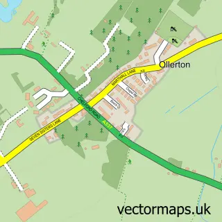
More street maps in Cheshire
750 metre map area coverage
Boundary, postcode and point of interest information for the 750m x 750m rectangle centred on this sample map.
Boundaries containing map centre
Constituency: Tatton Co Const
District: Cheshire West and Chester (B)
Icb: NHS Cheshire and Merseyside ICB
Parish: Nether Peover CP
Police Force: cheshire
Postcode District: WA16
Postcode Sector: WA16 9
Ward: Shakerley Ward
Nearby boundaries intersecting sample
District: Cheshire East (B)
Parish: Peover Inferior CP, Plumley CP
Ward: Chelford Ward
Postcode coverage
POI category counts
Cafe: 1
Church Cathedral: 1
Elementary School: 1
Event Planning: 1
Park: 1
Preschool: 1
Pub: 1
Wholesale Florist: 1
Sample points of interest
- Snowdrop Cafe
- St Oswald's Church
- Lower Peover CofE Primary School
- The Oak Tree Of Peover
- Tree Of Imagination
- The Little House Montessori
- Bells of Peover
- Kyoto Bonsai Ltd.
Create a larger editable map of Lower Peover
This sample shows only a 750 metre area. To create a larger map of Lower Peover, use our map builder to choose your own coverage area, add titles and download editable SVG, PDF and PNG files.
Create a custom map of Lower Peover