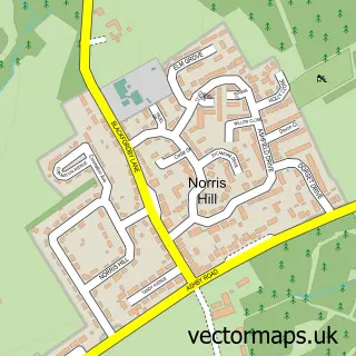
This Packington street map is a detailed vector street map covering a 750m x 750m area. Select a larger area to create and download your own vector street map of Packington.
The 750-metre map sample for Packington covers 312 mapped buildings and approximately 29.5 km of road detail, of which 20 named roads are named. The immediate area includes 1 school, 1 GP surgery within 2 miles, 2 pubs and 3 MOT stations within 2 miles. The wider area around Packington features 1 tourism point of interest and 3 food and drink venues. To create a larger or custom map of Packington, the map builder lets you define your own coverage area and download editable SVG, PDF and PNG files.
Create a larger editable map of Packington
Choose any area you need and generate a high-quality vector map instantly. Perfect for print, planning, design, business and personal use.

This Packington street map in Leicestershire is available as downloadable SVG, PDF and PNG map files, or as a printed map for planning, business, display, education, local information and design work. You can also create a larger custom map area using the map selector.
What this Packington map sample shows
Packington lies within Packington Cp parish, part of Ravenstone & Packington ward in the North West Leicestershire District local authority area. The postcode geography for this area includes the LE postcode area, the LE65 postcode district and the LE65 1 postcode sector. Residents fall under the Nhs Leicester, Leicestershire And Rutland Integrated Care Board for NHS services.
Local features near Packington
Within 2 milesAmenities and services in and around Packington.
Administrative and postcode information for Packington
Packington lies within Packington Cp parish, part of Ravenstone & Packington ward in the North West Leicestershire District local authority area. The postcode geography for this area includes the LE postcode area, the LE65 postcode district and the LE65 1 postcode sector. Residents fall under the Nhs Leicester, Leicestershire And Rutland Integrated Care Board for NHS services.
Nearby street map samples around Packington


More street maps in Leicestershire
750 metre map area coverage
Boundary, postcode and point of interest information for the 750m x 750m rectangle centred on this sample map.
Boundaries containing map centre
Constituency: North West Leicestershire Co Const
County: Leicestershire County
District: North West Leicestershire District
Icb: NHS Leicester Leicestershire and Rutland ICB
Parish: Packington CP
Police Force: leicestershire
Postcode District: LE65
Postcode Sector: LE65 1
Ward: Ravenstone & Packington Ward
Nearby boundaries intersecting sample
No additional intersecting boundaries found.
Postcode coverage
POI category counts
Church Cathedral: 2
Elementary School: 2
Pub: 2
Anglican Church: 1
Appliance Manufacturer: 1
Auto Electrical Repair: 1
Bakery: 1
Bookstore: 1
Building Supply Store: 1
Business Consulting: 1
Sample points of interest
- Packington: The Holy Rood
- Deva Dog Ware Limited
- A & J Bartlett Ltd.
- Sensational Sugar Art by Sarah Lou
- Context Bookshop
- Tyko Electrical Services
- Max Communications
- Context Products Ltd.
- The Professional Promotion Co. Ltd.
- Barkers Cafe
- Fern Carpets
- Holy Rood Church
Create a larger editable map of Packington
This sample shows only a 750 metre area. To create a larger map of Packington, use our map builder to choose your own coverage area, add titles and download editable SVG, PDF and PNG files.
Create a custom map of Packington