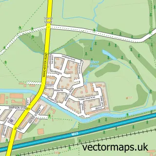
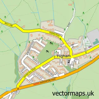
This Padiham street map is a detailed vector street map covering a 750m x 750m area. Select a larger area to create and download your own vector street map of Padiham.
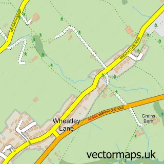
The 750-metre map sample for Padiham covers 323 mapped buildings and approximately 26.5 km of road detail, of which 102 named roads are named. The immediate area includes 2 schools, 1 GP surgery, with 3 within 2 miles, 10 pubs and 2 MOT stations, with 11 within 2 miles. The wider area around Padiham features 2 tourism points of interest, 17 food and drink venues and 1 hotel. To create a larger or custom map of Padiham, the map builder lets you define your own coverage area and download editable SVG, PDF and PNG files.
Create a larger editable map of Padiham
Choose any area you need and generate a high-quality vector map instantly. Perfect for print, planning, design, business and personal use.

This Padiham street map in Lancashire is available as downloadable SVG, PDF and PNG map files, or as a printed map for planning, business, display, education, local information and design work. You can also create a larger custom map area using the map selector.
What this Padiham map sample shows
Padiham lies within Padiham Cp parish, part of Gawthorpe ward in the Burnley District (B) local authority area. The postcode geography for this area includes the BB postcode area, the BB12 postcode district and the BB12 8 postcode sector. Residents fall under the Nhs Lancashire And South Cumbria Integrated Care Board for NHS services.
Local features near Padiham
Within 2 milesAmenities and services in and around Padiham.
Administrative and postcode information for Padiham
Padiham lies within Padiham Cp parish, part of Gawthorpe ward in the Burnley District (B) local authority area. The postcode geography for this area includes the BB postcode area, the BB12 postcode district and the BB12 8 postcode sector. Residents fall under the Nhs Lancashire And South Cumbria Integrated Care Board for NHS services.
Nearby street map samples around Padiham

More street maps in Lancashire
750 metre map area coverage
Boundary, postcode and point of interest information for the 750m x 750m rectangle centred on this sample map.
Boundaries containing map centre
Constituency: Burnley Co Const
County: Lancashire County
District: Burnley District (B)
Icb: NHS Lancashire and South Cumbria ICB
Parish: Padiham CP
Police Force: lancashire
Postcode District: BB12
Postcode Sector: BB12 8
Ward: Gawthorpe Ward
Nearby boundaries intersecting sample
Postcode Sector: BB12 7
Ward: Hapton with Park Ward
Postcode coverage
POI category counts
Beauty Salon: 11
Pub: 10
Hair Salon: 8
Barber: 6
Building Supply Store: 6
Clothing Store: 6
Cafe: 5
Flowers And Gifts Shop: 5
Indian Restaurant: 5
Banks: 4
Sample points of interest
- Aaa Tax & Accounting Services Ltd.
- Padiham and Burnley Accountancy Services
- St Leonard's Padiham
- Picture House
- Storm Art Gallery
- Storm Art Gallery
- All Electrical Supplies
- Crosshills Sheltered Housing
- Earful - Ear Wax Removal & Hearing Tests
- Monmouth Garage
- The Elite Refinishers
- A1 Motorstores
Create a larger editable map of Padiham
This sample shows only a 750 metre area. To create a larger map of Padiham, use our map builder to choose your own coverage area, add titles and download editable SVG, PDF and PNG files.
Create a custom map of Padiham