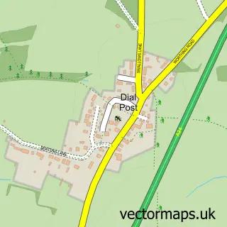
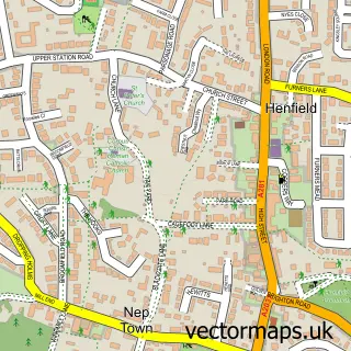
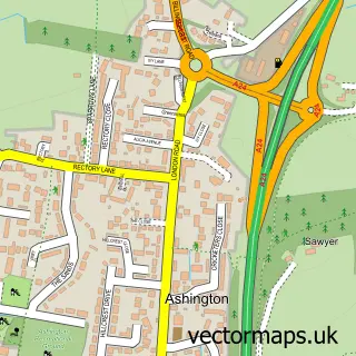
This Partridge Green street map is a detailed vector street map covering a 750m x 750m area. Select a larger area to create and download your own vector street map of Partridge Green.
The 750-metre map sample for Partridge Green covers 294 mapped buildings and approximately 11.2 km of road detail, of which 23 named roads are named. The immediate area includes 1 pub and 2 MOT stations. The wider area around Partridge Green features 1 tourism point of interest and 3 food and drink venues. To create a larger or custom map of Partridge Green, the map builder lets you define your own coverage area and download editable SVG, PDF and PNG files.
Create a larger editable map of Partridge Green
Choose any area you need and generate a high-quality vector map instantly. Perfect for print, planning, design, business and personal use.

This Partridge Green street map in West Sussex is available as downloadable SVG, PDF and PNG map files, or as a printed map for planning, business, display, education, local information and design work. You can also create a larger custom map area using the map selector.
What this Partridge Green map sample shows
Partridge Green lies within West Grinstead Cp parish, part of Cowfold, Shermanbury & West Grinstead ward in the Horsham District local authority area. The postcode geography for this area includes the RH postcode area, the RH13 postcode district and the RH13 8 postcode sector. Residents fall under the Nhs Sussex Integrated Care Board for NHS services.
Local features near Partridge Green
Within 2 milesAmenities and services in and around Partridge Green.
Administrative and postcode information for Partridge Green
Partridge Green lies within West Grinstead Cp parish, part of Cowfold, Shermanbury & West Grinstead ward in the Horsham District local authority area. The postcode geography for this area includes the RH postcode area, the RH13 postcode district and the RH13 8 postcode sector. Residents fall under the Nhs Sussex Integrated Care Board for NHS services.
Nearby street map samples around Partridge Green

More street maps in West Sussex
750 metre map area coverage
Boundary, postcode and point of interest information for the 750m x 750m rectangle centred on this sample map.
Boundaries containing map centre
Constituency: Horsham Co Const
County: West Sussex County
District: Horsham District
Icb: NHS Surrey and Sussex ICB
Parish: West Grinstead CP
Police Force: sussex
Postcode District: RH13
Postcode Sector: RH13 8
Ward: Cowfold, Shermanbury & West Grinstead Ward
Nearby boundaries intersecting sample
No additional intersecting boundaries found.
Postcode coverage
POI category counts
Bicycle Shop: 3
It Service And Computer Repair: 3
Professional Services: 3
Veterinarian: 3
Automotive Dealer: 2
Automotive Repair: 2
Bakery: 2
Books Mags Music And Video: 2
Building Supply Store: 2
Business Manufacturing And Supply: 2
Sample points of interest
- D C T Accounting Ltd
- Claremont Press
- St Michael's Church
- Vitech Scientific
- Claire Phillips Art Llp
- Sea White of Brighton Ltd.
- Seawhite of Brighton
- Base2 Music
- Six Audio
- Vivid Audio Uk Ltd.
- Wildbox Adventure Vehicles
- Whitebox UK
Create a larger editable map of Partridge Green
This sample shows only a 750 metre area. To create a larger map of Partridge Green, use our map builder to choose your own coverage area, add titles and download editable SVG, PDF and PNG files.
Create a custom map of Partridge Green