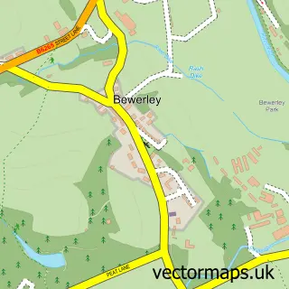
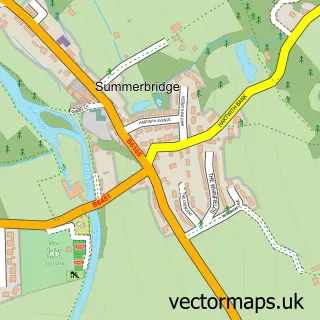
This Pateley Bridge street map is a detailed vector street map covering a 750m x 750m area. Select a larger area to create and download your own vector street map of Pateley Bridge.
The 750-metre map sample for Pateley Bridge covers 305 mapped buildings and approximately 16.5 km of road detail, of which 34 named roads are named. The immediate area includes 1 school, 1 GP surgery, 2 pubs and 1 MOT station. The wider area around Pateley Bridge features 9 tourism points of interest, 8 food and drink venues and 4 hotels. To create a larger or custom map of Pateley Bridge, the map builder lets you define your own coverage area and download editable SVG, PDF and PNG files.
Create a larger editable map of Pateley Bridge
Choose any area you need and generate a high-quality vector map instantly. Perfect for print, planning, design, business and personal use.

This Pateley Bridge street map in North Yorkshire is available as downloadable SVG, PDF and PNG map files, or as a printed map for planning, business, display, education, local information and design work. You can also create a larger custom map area using the map selector.
What this Pateley Bridge map sample shows
Pateley Bridge lies within High And Low Bishopside Cp parish, part of Pateley Bridge & Nidderdale Moors ward in the North Yorkshire local authority area. The postcode geography for this area includes the HG postcode area, the HG3 postcode district and the HG3 5 postcode sector. Residents fall under the Nhs Humber And North Yorkshire Integrated Care Board for NHS services.
Local features near Pateley Bridge
Within 2 milesAmenities and services in and around Pateley Bridge.
Administrative and postcode information for Pateley Bridge
The local authority covering Pateley Bridge is North Yorkshire, within the county of North Yorkshire. The settlement lies within Pateley Bridge & Nidderdale Moors ward and High And Low Bishopside Cp civil parish. The HG3 postcode district and HG3 5 postcode sector serve the immediate area. NHS provision in the area is delivered through Harrogate And District Nhs Foundation Trust.
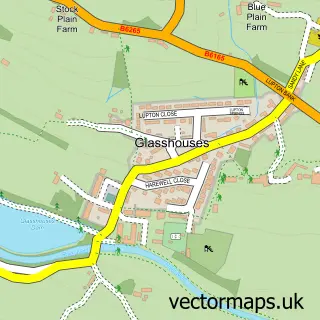
Nearby street map samples around Pateley Bridge


More street maps in North Yorkshire
750 metre map area coverage
Boundary, postcode and point of interest information for the 750m x 750m rectangle centred on this sample map.
Boundaries containing map centre
Constituency: Skipton and Ripon Co Const
District: North Yorkshire
Icb: NHS Humber and North Yorkshire ICB
Parish: High and Low Bishopside CP
Police Force: north yorkshire
Postcode District: HG3
Postcode Sector: HG3 5
Nearby boundaries intersecting sample
Parish: Bewerley CP
Postcode coverage
POI category counts
Butcher Shop: 4
Convenience Store: 4
Flowers And Gifts Shop: 4
Hotel: 4
Park: 4
Art Gallery: 3
Bed And Breakfast: 3
Jewelry Store: 3
Professional Services: 3
Restaurant: 3
Sample points of interest
- Simon Ward Acupuncture Pateley Bridge
- The Nidderdale Agricultural Society
- Pateley Bridge Ambulance Station
- St Cuthbert's Church
- St Cuthbert's, Pateley Bridge
- Crows Nest Antiques
- Pateley Bridge Antiques
- Grimaldi and Galloway
- Jack Albert & Gill 2
- Zeitgeist Fine Art
- Pateley Makers Yard
- Dodie Hallas Ceramic Sculpture
Create a larger editable map of Pateley Bridge
This sample shows only a 750 metre area. To create a larger map of Pateley Bridge, use our map builder to choose your own coverage area, add titles and download editable SVG, PDF and PNG files.
Create a custom map of Pateley Bridge