This Pentrefoelas street map is a detailed vector street map covering a 750m x 750m area. Select a larger area to create and download your own vector street map of Pentrefoelas.
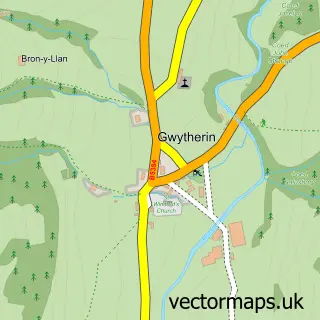
The 750-metre map sample for Pentrefoelas covers 55 mapped buildings and approximately 6.0 km of road detail, of which 1 named road are named. The immediate area includes 1 school. The wider area around Pentrefoelas features 1 food and drink venue, 2 hotels and 2 campsites within 2 miles. To create a larger or custom map of Pentrefoelas, the map builder lets you define your own coverage area and download editable SVG, PDF and PNG files.
Create a larger editable map of Pentrefoelas
Choose any area you need and generate a high-quality vector map instantly. Perfect for print, planning, design, business and personal use.

This Pentrefoelas street map in Clwyd is available as downloadable SVG, PDF and PNG map files, or as a printed map for planning, business, display, education, local information and design work. You can also create a larger custom map area using the map selector.
What this Pentrefoelas map sample shows
Pentrefoelas lies within Pentrefoelas Community parish, part of Llangernyw ward in the Conwy - Conwy local authority area. The postcode geography for this area includes the LL postcode area, the LL24 postcode district and the LL24 0 postcode sector. Residents fall under the Betsi Cadwaladr University Health Board for NHS services.
Local features near Pentrefoelas
Within 2 milesAmenities and services in and around Pentrefoelas.
Administrative and postcode information for Pentrefoelas
Pentrefoelas lies within Pentrefoelas Community parish, part of Llangernyw ward in the Conwy - Conwy local authority area. The postcode geography for this area includes the LL postcode area, the LL24 postcode district and the LL24 0 postcode sector. Residents fall under the Betsi Cadwaladr University Health Board for NHS services.
Nearby street map samples around Pentrefoelas

More street maps in Clwyd
750 metre map area coverage
Boundary, postcode and point of interest information for the 750m x 750m rectangle centred on this sample map.
Boundaries containing map centre
Constituency: Bangor Aberconwy Co Const
District: Conwy - Conwy
Icb: Betsi Cadwaladr University
Parish: Pentrefoelas Community
Police Force: north wales
Postcode District: LL24
Postcode Sector: LL24 0
Nearby boundaries intersecting sample
No additional intersecting boundaries found.
Postcode coverage
POI category counts
Convenience Store: 2
Hotel: 2
Cafe: 1
Day Care Preschool: 1
Elementary School: 1
Nursery And Gardening: 1
Retirement Home: 1
Shipping Center: 1
Sample points of interest
- Bocs Bwyd
- Costcutter
- Siop Pentrefoelas Shop
- Meithrinfa Twtlol Bach
- Pentrefoelas County Primary School
- Foelas Arms Hotel
- Hafod Hall
- Cottage Orchard
- Cartref Bryn Yr Eglwys Residence on the Church Hill
- Post Office
Create a larger editable map of Pentrefoelas
This sample shows only a 750 metre area. To create a larger map of Pentrefoelas, use our map builder to choose your own coverage area, add titles and download editable SVG, PDF and PNG files.
Create a custom map of Pentrefoelas