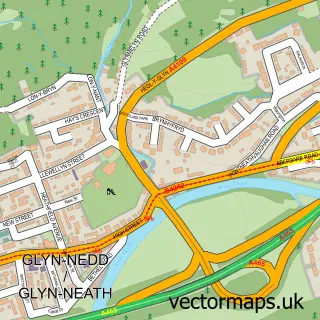
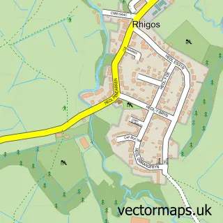
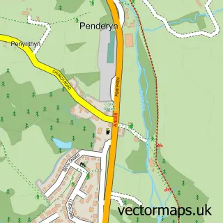
This Pontwalby street map is a detailed vector street map covering a 750m x 750m area. Select a larger area to create and download your own vector street map of Pontwalby.
The 750-metre map sample for Pontwalby covers 211 mapped buildings and approximately 24.3 km of road detail, of which 9 named roads are named. The immediate area includes 3 MOT stations within 2 miles. To create a larger or custom map of Pontwalby, the map builder lets you define your own coverage area and download editable SVG, PDF and PNG files.
Create a larger editable map of Pontwalby
Choose any area you need and generate a high-quality vector map instantly. Perfect for print, planning, design, business and personal use.

This Pontwalby street map in West Glamorgan is available as downloadable SVG, PDF and PNG map files, or as a printed map for planning, business, display, education, local information and design work. You can also create a larger custom map area using the map selector.
What this Pontwalby map sample shows
Pontwalby lies within Glynneath Community parish, part of Glynneath ward in the Castell-Nedd Port Talbot - Neath Port Talbot local authority area. The postcode geography for this area includes the SA postcode area, the SA11 postcode district and the SA11 5 postcode sector. Residents fall under the Swansea Bay University Local Health Board for NHS services.
Local features near Pontwalby
Within 2 milesAmenities and services in and around Pontwalby.
Administrative and postcode information for Pontwalby
Pontwalby lies within Glynneath Community parish, part of Glynneath ward in the Castell-Nedd Port Talbot - Neath Port Talbot local authority area. The postcode geography for this area includes the SA postcode area, the SA11 postcode district and the SA11 5 postcode sector. Residents fall under the Swansea Bay University Local Health Board for NHS services.
Nearby street map samples around Pontwalby

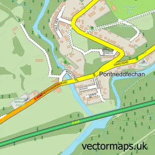
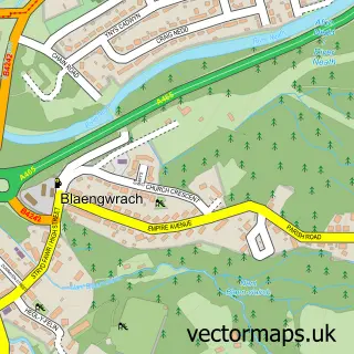
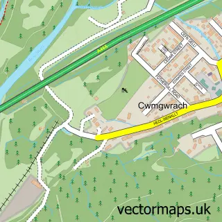
More street maps in West Glamorgan
750 metre map area coverage
Boundary, postcode and point of interest information for the 750m x 750m rectangle centred on this sample map.
Boundaries containing map centre
Constituency: Neath and Swansea East Co Const
District: Castell-nedd Port Talbot - Neath Port Talbot
Icb: Abertawe Bro Morgannwg University
Parish: Glynneath Community
Police Force: south wales
Postcode District: SA11
Postcode Sector: SA11 5
Nearby boundaries intersecting sample
Parish: Blaengwrach Community
Postcode coverage
POI category counts
Building Supply Store: 1
Indian Restaurant: 1
Industrial Equipment: 1
Monument: 1
Printing Services: 1
Religious Organization: 1
Sewing And Alterations: 1
Shopping: 1
Sample points of interest
- Atom Heating Ltd
- Taste Of Bombay Indian Cardiff
- Warmaglaze Home Improvements
- Pontwalby Viaduct
- Challenger Prints
- South Cefncaeau Family Centre (Ty Enfys)
- Sew Perfect
- Clydach Market
Create a larger editable map of Pontwalby
This sample shows only a 750 metre area. To create a larger map of Pontwalby, use our map builder to choose your own coverage area, add titles and download editable SVG, PDF and PNG files.
Create a custom map of Pontwalby