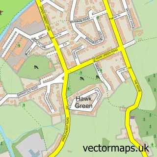
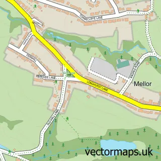
This Poynton street map is a detailed vector street map covering a 750m x 750m area. Select a larger area to create and download your own vector street map of Poynton.
The 750-metre map sample for Poynton covers 480 mapped buildings and approximately 15.0 km of road detail, of which 35 named roads are named. The immediate area includes 1 school, 4 pubs and 1 MOT station, with 5 within 2 miles. The wider area around Poynton features 14 food and drink venues. To create a larger or custom map of Poynton, the map builder lets you define your own coverage area and download editable SVG, PDF and PNG files.
Create a larger editable map of Poynton
Choose any area you need and generate a high-quality vector map instantly. Perfect for print, planning, design, business and personal use.

This Poynton street map in Cheshire is available as downloadable SVG, PDF and PNG map files, or as a printed map for planning, business, display, education, local information and design work. You can also create a larger custom map area using the map selector.
What this Poynton map sample shows
Poynton lies within Poynton With Worth Cp parish, part of Poynton East And Pott Shrigley ward in the Cheshire East (B) local authority area. The postcode geography for this area includes the SK postcode area, the SK12 postcode district and the SK12 1 postcode sector. Residents fall under the Nhs Cheshire And Merseyside Integrated Care Board for NHS services.
Local features near Poynton
Within 2 milesAmenities and services in and around Poynton.
Administrative and postcode information for Poynton
The local authority covering Poynton is Cheshire East (B), within the county of Cheshire. The settlement lies within Poynton East And Pott Shrigley ward and Poynton With Worth Cp civil parish. The SK12 postcode district and SK12 1 postcode sector serve the immediate area. NHS provision in the area is delivered through East Cheshire Nhs Trust.
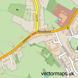
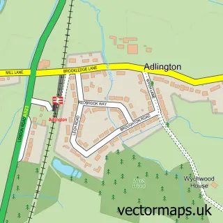
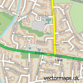
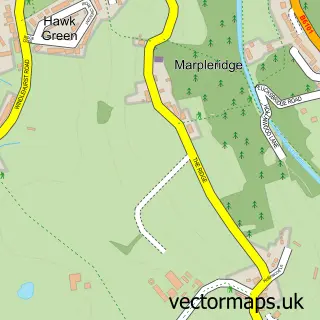
Nearby street map samples around Poynton

More street maps in Cheshire
750 metre map area coverage
Boundary, postcode and point of interest information for the 750m x 750m rectangle centred on this sample map.
Boundaries containing map centre
Constituency: Macclesfield Co Const
District: Cheshire East (B)
Icb: NHS Cheshire and Merseyside ICB
Parish: Poynton with Worth CP
Police Force: cheshire
Postcode District: SK12
Postcode Sector: SK12 1
Ward: Poynton East and Pott Shrigley Ward
Nearby boundaries intersecting sample
Ward: Poynton West and Adlington Ward
Postcode coverage
POI category counts
Hair Salon: 12
Beauty Salon: 11
Jewelry Store: 8
Barber: 7
Financial Service: 7
Beauty And Spa: 5
Funeral Services And Cemeteries: 5
Pizza Restaurant: 5
Sports Club And League: 5
Cafe: 4
Sample points of interest
- Leathley & Co
- NealFord
- Daniel J Windridge BSc (Hons) TCM Acu, MBAcC.
- Poynton Osteopathic Clinic & Natural Therapy Centre
- Tania Ann Prince
- Poynton Lacrosse Club
- Birch Hall Boarding Kennels & Cattery
- Colourfield Antiques
- Recollections
- Design Solutions
- P Z Vi Architects & Designers Ltd.
- Maydean Design
Create a larger editable map of Poynton
This sample shows only a 750 metre area. To create a larger map of Poynton, use our map builder to choose your own coverage area, add titles and download editable SVG, PDF and PNG files.
Create a custom map of Poynton