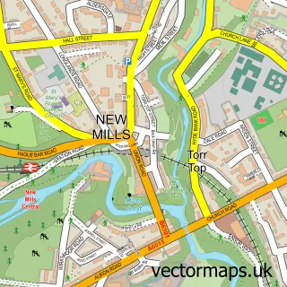
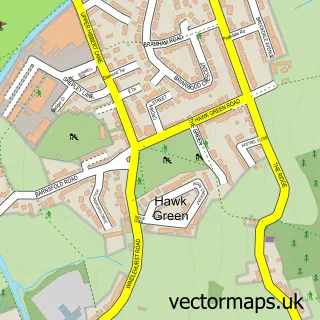
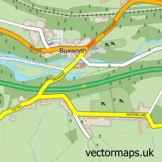
This Disley street map is a detailed vector street map covering a 750m x 750m area. Select a larger area to create and download your own vector street map of Disley.
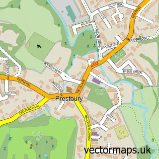
The 750-metre map sample for Disley covers 479 mapped buildings and approximately 20.9 km of road detail, of which 41 named roads are named. The immediate area includes 1 school, 3 GP surgeries within 2 miles, 8 pubs and 2 MOT stations, with 7 within 2 miles. The wider area around Disley features 11 food and drink venues. To create a larger or custom map of Disley, the map builder lets you define your own coverage area and download editable SVG, PDF and PNG files.
Create a larger editable map of Disley
Choose any area you need and generate a high-quality vector map instantly. Perfect for print, planning, design, business and personal use.

This Disley street map in Cheshire is available as downloadable SVG, PDF and PNG map files, or as a printed map for planning, business, display, education, local information and design work. You can also create a larger custom map area using the map selector.
What this Disley map sample shows
Disley lies within Disley Cp parish, part of Disley ward in the Cheshire East (B) local authority area. The postcode geography for this area includes the SK postcode area, the SK12 postcode district and the SK12 2 postcode sector. Residents fall under the Nhs Cheshire And Merseyside Integrated Care Board for NHS services.
Local features near Disley
Within 2 milesAmenities and services in and around Disley.
Administrative and postcode information for Disley
The local authority covering Disley is Cheshire East (B), within the county of Cheshire. The settlement lies within Disley ward and Disley Cp civil parish. The SK12 postcode district and SK12 2 postcode sector serve the immediate area. NHS provision in the area is delivered through Stockport Nhs Foundation Trust.
Nearby street map samples around Disley

More street maps in Cheshire
750 metre map area coverage
Boundary, postcode and point of interest information for the 750m x 750m rectangle centred on this sample map.
Boundaries containing map centre
Constituency: Macclesfield Co Const
District: Cheshire East (B)
Icb: NHS Cheshire and Merseyside ICB
Parish: Disley CP
Police Force: cheshire
Postcode District: SK12
Postcode Sector: SK12 2
Ward: Disley Ward
Nearby boundaries intersecting sample
No additional intersecting boundaries found.
Postcode coverage
POI category counts
Pub: 8
Automotive Repair: 5
Beauty Salon: 4
Chinese Restaurant: 3
Community Services Non Profits: 3
Dentist: 3
Financial Service: 3
Hair Salon: 3
Accountant: 2
Anglican Church: 2
Sample points of interest
- Castletree Consultants Limited
- Disley and High Peak Accountants
- St Mary's Church
- St Mary's Parish Church
- Mill Farm Antiques
- Bridgfords
- Naughty Dog Creative Framing
- Golden Kitchen
- Payzone
- The Cooperative Food (BF) Disley, Disley
- Cheshire East Car Care
- Moortop Garage
Create a larger editable map of Disley
This sample shows only a 750 metre area. To create a larger map of Disley, use our map builder to choose your own coverage area, add titles and download editable SVG, PDF and PNG files.
Create a custom map of Disley