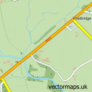
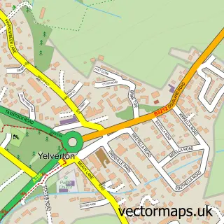
This Princetown street map is a detailed vector street map covering a 750m x 750m area. Select a larger area to create and download your own vector street map of Princetown.
The 750-metre map sample for Princetown covers 155 mapped buildings and approximately 22.3 km of road detail, of which 13 named roads are named. The immediate area includes 1 school and 3 pubs. The wider area around Princetown features 4 tourism points of interest, 6 food and drink venues and 3 hotels. To create a larger or custom map of Princetown, the map builder lets you define your own coverage area and download editable SVG, PDF and PNG files.
Create a larger editable map of Princetown
Choose any area you need and generate a high-quality vector map instantly. Perfect for print, planning, design, business and personal use.

This Princetown street map in Devon is available as downloadable SVG, PDF and PNG map files, or as a printed map for planning, business, display, education, local information and design work. You can also create a larger custom map area using the map selector.
What this Princetown map sample shows
Princetown lies within Dartmoor Forest Cp parish, part of Dartmoor ward in the West Devon District (B) local authority area. The postcode geography for this area includes the PL postcode area, the PL20 postcode district and the PL20 6 postcode sector. Residents fall under the Nhs Devon Integrated Care Board for NHS services.
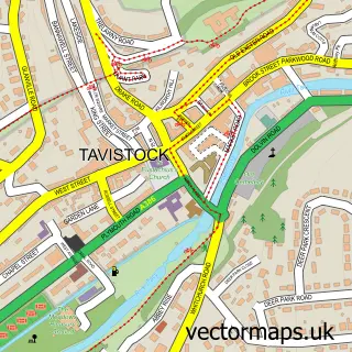
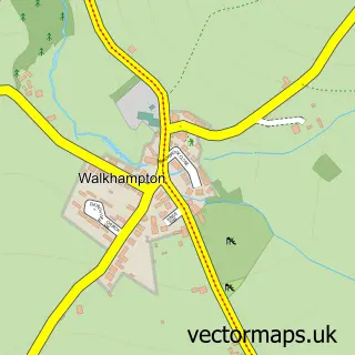
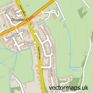
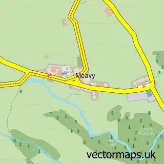
Local features near Princetown
Within 2 milesAmenities and services in and around Princetown.
Administrative and postcode information for Princetown
The local authority covering Princetown is West Devon District (B), within the county of Devon. The settlement lies within Dartmoor ward and Dartmoor Forest Cp civil parish. The PL20 postcode district and PL20 6 postcode sector serve the immediate area. NHS provision in the area is delivered through Royal Devon University Healthcare Nhs Foundation Trust.
Nearby street map samples around Princetown

More street maps in Devon
750 metre map area coverage
Boundary, postcode and point of interest information for the 750m x 750m rectangle centred on this sample map.
Boundaries containing map centre
Constituency: Torridge and Tavistock Co Const
County: Devon County
District: West Devon District (B)
Icb: NHS Devon ICB
Parish: Dartmoor Forest CP
Police Force: devon and cornwall
Postcode District: PL20
Postcode Sector: PL20 6
Ward: Dartmoor Ward
Nearby boundaries intersecting sample
Constituency: South West Devon Co Const
Parish: Walkhampton CP
Ward: Burrator Ward
Postcode coverage
POI category counts
Charity Organization: 3
Convenience Store: 3
Hotel: 3
Pub: 3
Arts And Entertainment: 2
Brewery: 2
Cafe: 2
Clothing Store: 2
Environmental Conservation Organization: 2
Guest House: 2
Sample points of interest
- Moor Appliances
- TankBred
- Mother of Dragons
- Dartmoor Prison
- Prince Of Wales, Princetown
- Crag 2 Mountain
- Lloyds Bank
- The Railway Inn
- Dartmoor Brewery
- Dartmoor Brewery
- Jayne's at Princetown
- Pressed Men
Create a larger editable map of Princetown
This sample shows only a 750 metre area. To create a larger map of Princetown, use our map builder to choose your own coverage area, add titles and download editable SVG, PDF and PNG files.
Create a custom map of Princetown