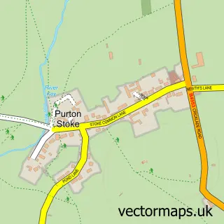
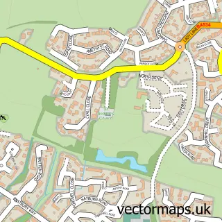
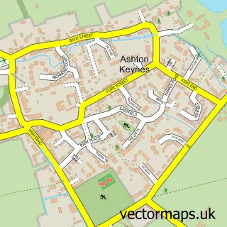
This Purton street map is a detailed vector street map covering a 750m x 750m area. Select a larger area to create and download your own vector street map of Purton.
The 750-metre map sample for Purton covers 297 mapped buildings and approximately 12.3 km of road detail, of which 16 named roads are named. The immediate area includes 1 primary school and 1 secondary school, 2 GP surgeries within 2 miles, 2 pubs and 4 MOT stations within 2 miles. The wider area around Purton features 1 tourism point of interest and 5 food and drink venues. To create a larger or custom map of Purton, the map builder lets you define your own coverage area and download editable SVG, PDF and PNG files.
Create a larger editable map of Purton
Choose any area you need and generate a high-quality vector map instantly. Perfect for print, planning, design, business and personal use.

This Purton street map in Wiltshire is available as downloadable SVG, PDF and PNG map files, or as a printed map for planning, business, display, education, local information and design work. You can also create a larger custom map area using the map selector.
What this Purton map sample shows
Purton lies within Purton Cp parish, part of Purton ward in the Wiltshire local authority area. The postcode geography for this area includes the SN postcode area, the SN5 postcode district and the SN5 4 postcode sector. Residents fall under the Nhs Bath And North East Somerset, Swindon And Wiltshire Integrated Care Board for NHS services.
Local features near Purton
Within 2 milesAmenities and services in and around Purton.
Administrative and postcode information for Purton
Purton lies within Purton Cp parish, part of Purton ward in the Wiltshire local authority area. The postcode geography for this area includes the SN postcode area, the SN5 postcode district and the SN5 4 postcode sector. Residents fall under the Nhs Bath And North East Somerset, Swindon And Wiltshire Integrated Care Board for NHS services.
Nearby street map samples around Purton

More street maps in Wiltshire
750 metre map area coverage
Boundary, postcode and point of interest information for the 750m x 750m rectangle centred on this sample map.
Boundaries containing map centre
Constituency: South Cotswolds Co Const
District: Wiltshire
Icb: NHS Bath and North East Somerset Swindon and Wiltshire ICB
Parish: Purton CP
Police Force: wiltshire
Postcode District: SN5
Postcode Sector: SN5 4
Nearby boundaries intersecting sample
No additional intersecting boundaries found.
Postcode coverage
POI category counts
Cafe: 3
Dentist: 2
Elementary School: 2
Home Service: 2
Pub: 2
Retail: 2
Sports Club And League: 2
Veterinarian: 2
Accountant: 1
Amateur Sports Team: 1
Sample points of interest
- Harwood & Partners Accounting Solutions
- Purton FC
- Agius General Electrical Services
- Cyclecare
- Dora's Kiosk
- Pips Community Cafe
- The Maharajah Restaurants
- Purton Methodist Church
- Elm Grove Saddlery - Elmgrove Saddlery Wiltshire
- Purton Village Hall
- Co-op Food
- Cooke Philip Jonathan William
Create a larger editable map of Purton
This sample shows only a 750 metre area. To create a larger map of Purton, use our map builder to choose your own coverage area, add titles and download editable SVG, PDF and PNG files.
Create a custom map of Purton