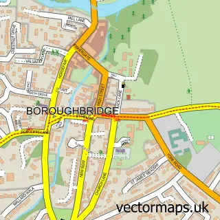
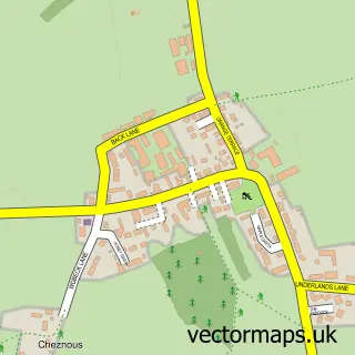
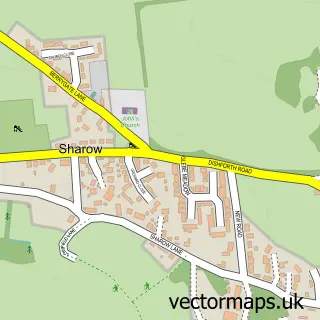
This Rainton street map is a detailed vector street map covering a 750m x 750m area. Select a larger area to create and download your own vector street map of Rainton.
The 750-metre map sample for Rainton covers 184 mapped buildings and approximately 12.9 km of road detail, of which 7 named roads are named. The immediate area includes 1 pub. The wider area around Rainton features 1 tourism point of interest and 1 food and drink venue. To create a larger or custom map of Rainton, the map builder lets you define your own coverage area and download editable SVG, PDF and PNG files.
Create a larger editable map of Rainton
Choose any area you need and generate a high-quality vector map instantly. Perfect for print, planning, design, business and personal use.

This Rainton street map in North Yorkshire is available as downloadable SVG, PDF and PNG map files, or as a printed map for planning, business, display, education, local information and design work. You can also create a larger custom map area using the map selector.
What this Rainton map sample shows
Rainton lies within Rainton With Newby Cp parish, part of Wathvale ward in the North Yorkshire local authority area. The postcode geography for this area includes the YO postcode area, the YO7 postcode district and the YO7 3 postcode sector. Residents fall under the Nhs Humber And North Yorkshire Integrated Care Board for NHS services.
Local features near Rainton
Within 2 milesAmenities and services in and around Rainton.
Administrative and postcode information for Rainton
Rainton lies within Rainton With Newby Cp parish, part of Wathvale ward in the North Yorkshire local authority area. The postcode geography for this area includes the YO postcode area, the YO7 postcode district and the YO7 3 postcode sector. Residents fall under the Nhs Humber And North Yorkshire Integrated Care Board for NHS services.
Nearby street map samples around Rainton

More street maps in North Yorkshire
750 metre map area coverage
Boundary, postcode and point of interest information for the 750m x 750m rectangle centred on this sample map.
Boundaries containing map centre
Constituency: Skipton and Ripon Co Const
District: North Yorkshire
Icb: NHS Humber and North Yorkshire ICB
Parish: Rainton with Newby CP
Police Force: north yorkshire
Postcode District: YO7
Postcode Sector: YO7 3
Nearby boundaries intersecting sample
No additional intersecting boundaries found.
Postcode coverage
POI category counts
Advertising Agency: 1
Aesthetician: 1
Anglican Church: 1
Attractions And Activities: 1
Automotive Parts And Accessories: 1
Beauty Salon: 1
Building Contractor: 1
Fair: 1
Flowers And Gifts Shop: 1
Home Cleaning: 1
Sample points of interest
- S W Design Group
- Magnifique Beauty Aesthetics
- Rainton Mission Room
- Rainton Recreation Field
- D&R Trailerfix
- Magnifique Beauty
- Advent Rooflines
- Straight Shooters Ltd.
- Yvonne Dennis Wedding Flowers
- White Rose Cleaning & Maintenance Services
- Bay Horse Inn
- Scruffs2Fluffs
Create a larger editable map of Rainton
This sample shows only a 750 metre area. To create a larger map of Rainton, use our map builder to choose your own coverage area, add titles and download editable SVG, PDF and PNG files.
Create a custom map of Rainton