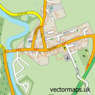
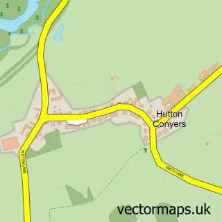
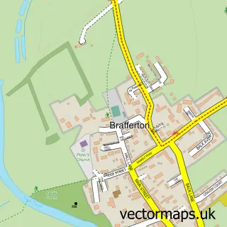
This Dishforth street map is a detailed vector street map covering a 750m x 750m area. Select a larger area to create and download your own vector street map of Dishforth.
The 750-metre map sample for Dishforth covers 301 mapped buildings and approximately 13.0 km of road detail, of which 8 named roads are named. The immediate area includes 1 school and 1 pub. The wider area around Dishforth features 1 food and drink venue and 1 hotel. To create a larger or custom map of Dishforth, the map builder lets you define your own coverage area and download editable SVG, PDF and PNG files.
Create a larger editable map of Dishforth
Choose any area you need and generate a high-quality vector map instantly. Perfect for print, planning, design, business and personal use.

This Dishforth street map in North Yorkshire is available as downloadable SVG, PDF and PNG map files, or as a printed map for planning, business, display, education, local information and design work. You can also create a larger custom map area using the map selector.
What this Dishforth map sample shows
Dishforth lies within Dishforth Cp parish, part of Wathvale ward in the North Yorkshire local authority area. The postcode geography for this area includes the YO postcode area, the YO7 postcode district and the YO7 3 postcode sector. Residents fall under the Nhs Humber And North Yorkshire Integrated Care Board for NHS services.
Local features near Dishforth
Within 2 milesAmenities and services in and around Dishforth.
Administrative and postcode information for Dishforth
Dishforth lies within Dishforth Cp parish, part of Wathvale ward in the North Yorkshire local authority area. The postcode geography for this area includes the YO postcode area, the YO7 postcode district and the YO7 3 postcode sector. Residents fall under the Nhs Humber And North Yorkshire Integrated Care Board for NHS services.
Nearby street map samples around Dishforth

More street maps in North Yorkshire
750 metre map area coverage
Boundary, postcode and point of interest information for the 750m x 750m rectangle centred on this sample map.
Boundaries containing map centre
Constituency: Skipton and Ripon Co Const
District: North Yorkshire
Icb: NHS Humber and North Yorkshire ICB
Parish: Dishforth CP
Police Force: north yorkshire
Postcode District: YO7
Postcode Sector: YO7 3
Nearby boundaries intersecting sample
No additional intersecting boundaries found.
Postcode coverage
POI category counts
Post Office: 2
Advertising Agency: 1
Animal Shelter: 1
Audio Visual Equipment Store: 1
Bar: 1
Elementary School: 1
Gardener: 1
Hotel: 1
Pet Boarding: 1
Plumbing: 1
Sample points of interest
- The Beehive Partnership
- Cats at Fern Bank
- Fusionlx ltd
- The Crown Inn
- Dishforth Church of England Primary School
- IMS Landscape Consultancy
- Crown Inn, Dishforth
- The Yorkshire Pet Sitting Lass
- Paul Taylor Plumbing Services
- Dishforth Post Office
- Post Office-Dishforth
- Black Swan
Create a larger editable map of Dishforth
This sample shows only a 750 metre area. To create a larger map of Dishforth, use our map builder to choose your own coverage area, add titles and download editable SVG, PDF and PNG files.
Create a custom map of Dishforth