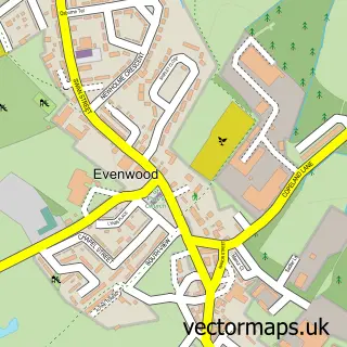
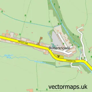
This Ramshaw street map is a detailed vector street map covering a 750m x 750m area. Select a larger area to create and download your own vector street map of Ramshaw.
The 750-metre map sample for Ramshaw covers 100 mapped buildings and approximately 7.3 km of road detail, of which 3 named roads are named. The immediate area includes 1 school, 2 GP surgeries within 2 miles, 1 pub and 3 MOT stations within 2 miles. The wider area around Ramshaw features 1 tourism point of interest and 1 food and drink venue. To create a larger or custom map of Ramshaw, the map builder lets you define your own coverage area and download editable SVG, PDF and PNG files.
Create a larger editable map of Ramshaw
Choose any area you need and generate a high-quality vector map instantly. Perfect for print, planning, design, business and personal use.

This Ramshaw street map in Durham is available as downloadable SVG, PDF and PNG map files, or as a printed map for planning, business, display, education, local information and design work. You can also create a larger custom map area using the map selector.
What this Ramshaw map sample shows
Ramshaw lies within Evenwood And Barony Cp parish, part of Evenwood ward in the County Durham local authority area. The postcode geography for this area includes the DL postcode area, the DL14 postcode district and the DL14 9 postcode sector. Residents fall under the Nhs North East And North Cumbria Integrated Care Board for NHS services.
Local features near Ramshaw
Within 2 milesAmenities and services in and around Ramshaw.
Administrative and postcode information for Ramshaw
The local authority covering Ramshaw is County Durham, within the county of Durham. The settlement lies within Evenwood ward and Evenwood And Barony Cp civil parish. The DL14 postcode district and DL14 9 postcode sector serve the immediate area. NHS provision in the area is delivered through County Durham And Darlington Nhs Foundation Trust.
Nearby street map samples around Ramshaw
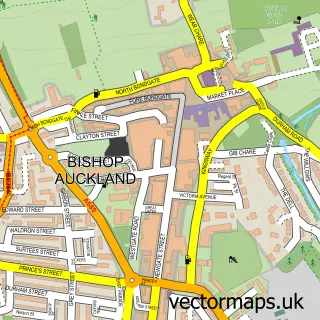

More street maps in Durham
750 metre map area coverage
Boundary, postcode and point of interest information for the 750m x 750m rectangle centred on this sample map.
Boundaries containing map centre
Constituency: Bishop Auckland Co Const
District: County Durham
Icb: NHS North East and North Cumbria ICB
Parish: Evenwood and Barony CP
Police Force: durham
Postcode District: DL14
Postcode Sector: DL14 0
Nearby boundaries intersecting sample
Postcode Sector: DL14 9
Postcode coverage
POI category counts
Accommodation: 1
Arts And Entertainment: 1
Automotive Repair: 1
Bar: 1
Campground: 1
Elementary School: 1
Environmental Conservation Organization: 1
Event Technology Service: 1
Online Shop: 1
Pub: 1
Sample points of interest
- Norwood Stables
- Quax Artwork
- Enterprise Rent-a-Car
- Cunninghams family Bar & restaurant
- Cragwood holiday home Park, riverside touring park
- Ramshaw Primary School
- Applied Ecological Services
- County Durham Wedding D J
- Bluebird Country Supplies
- The Bridge Inn
Create a larger editable map of Ramshaw
This sample shows only a 750 metre area. To create a larger map of Ramshaw, use our map builder to choose your own coverage area, add titles and download editable SVG, PDF and PNG files.
Create a custom map of Ramshaw