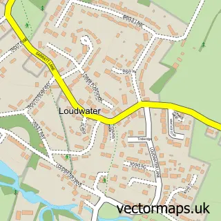
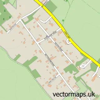
This Rickmansworth street map is a detailed vector street map covering a 750m x 750m area. Select a larger area to create and download your own vector street map of Rickmansworth.
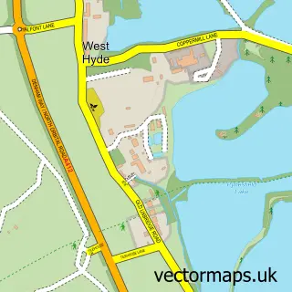
The 750-metre map sample for Rickmansworth covers 243 mapped buildings and approximately 18.1 km of road detail, of which 33 named roads are named. The immediate area includes 1 railway station, 4 GP surgeries within 2 miles, 5 pubs and 1 MOT station, with 6 within 2 miles. The wider area around Rickmansworth features 4 tourism points of interest, 16 food and drink venues and 1 hotel. To create a larger or custom map of Rickmansworth, the map builder lets you define your own coverage area and download editable SVG, PDF and PNG files.
Create a larger editable map of Rickmansworth
Choose any area you need and generate a high-quality vector map instantly. Perfect for print, planning, design, business and personal use.

This Rickmansworth street map in Hertfordshire is available as downloadable SVG, PDF and PNG map files, or as a printed map for planning, business, display, education, local information and design work. You can also create a larger custom map area using the map selector.
What this Rickmansworth map sample shows
Rickmansworth lies within Batchworth Cp parish, part of Rickmansworth Town ward in the Three Rivers District local authority area. The postcode geography for this area includes the WD postcode area, the WD3 postcode district and the WD3 7 postcode sector. Residents fall under the Nhs Hertfordshire And West Essex Integrated Care Board for NHS services.
Local features near Rickmansworth
Within 2 milesAmenities and services in and around Rickmansworth.
Administrative and postcode information for Rickmansworth
Rickmansworth lies within Batchworth Cp parish, part of Rickmansworth Town ward in the Three Rivers District local authority area. The postcode geography for this area includes the WD postcode area, the WD3 postcode district and the WD3 7 postcode sector. Residents fall under the Nhs Hertfordshire And West Essex Integrated Care Board for NHS services.
Nearby street map samples around Rickmansworth

More street maps in Hertfordshire
750 metre map area coverage
Boundary, postcode and point of interest information for the 750m x 750m rectangle centred on this sample map.
Boundaries containing map centre
Constituency: South West Hertfordshire Co Const
County: Hertfordshire County
District: Three Rivers District
Icb: NHS Central East ICB
Parish: Batchworth CP
Police Force: hertfordshire
Postcode District: WD3
Postcode Sector: WD3 1
Ward: Rickmansworth Town Ward
Nearby boundaries intersecting sample
Postcode Sector: WD3 4, WD3 7
Postcode coverage
POI category counts
Real Estate Agent: 16
Professional Services: 12
Financial Service: 10
Retail: 8
Hair Salon: 7
It Service And Computer Repair: 7
Cafe: 6
Employment Agencies: 6
Financial Advising: 6
Community Services Non Profits: 5
Sample points of interest
- Numerii Ltd.
- Smith-Milne & Co.
- Natural Medical Clinic
- Akwan Strategic Media
- Hunter Lodge Design
- Hunterlodge Advertising
- Media Five
- St Mary's Church, Rickmansworth
- RSPCA
- Hamptons International Lettings
- Collectibles
- ARPM
Create a larger editable map of Rickmansworth
This sample shows only a 750 metre area. To create a larger map of Rickmansworth, use our map builder to choose your own coverage area, add titles and download editable SVG, PDF and PNG files.
Create a custom map of Rickmansworth