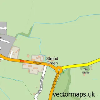
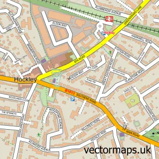
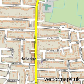
This Rochford street map is a detailed vector street map covering a 750m x 750m area. Select a larger area to create and download your own vector street map of Rochford.
The 750-metre map sample for Rochford covers 453 mapped buildings and approximately 16.8 km of road detail, of which 39 named roads are named. The immediate area includes 2 schools, 1 railway station, 1 GP surgery, with 5 within 2 miles and 7 pubs among other local services. The wider area around Rochford features 7 tourism points of interest, 13 food and drink venues and 1 hotel. To create a larger or custom map of Rochford, the map builder lets you define your own coverage area and download editable SVG, PDF and PNG files.
Create a larger editable map of Rochford
Choose any area you need and generate a high-quality vector map instantly. Perfect for print, planning, design, business and personal use.

This Rochford street map in Essex is available as downloadable SVG, PDF and PNG map files, or as a printed map for planning, business, display, education, local information and design work. You can also create a larger custom map area using the map selector.
What this Rochford map sample shows
Rochford lies within Rochford Cp parish, part of Roche South ward in the Rochford District local authority area. The postcode geography for this area includes the SS postcode area, the SS4 postcode district and the SS4 1 postcode sector. Residents fall under the Nhs Mid And South Essex Integrated Care Board for NHS services.
Local features near Rochford
Within 2 milesAmenities and services in and around Rochford.
Administrative and postcode information for Rochford
The local authority covering Rochford is Rochford District, within the county of Essex. The settlement lies within Roche South ward and Rochford Cp civil parish. The SS4 postcode district and SS4 1 postcode sector serve the immediate area. NHS provision in the area is delivered through Mid And South Essex Nhs Foundation Trust.
Nearby street map samples around Rochford

More street maps in Essex
750 metre map area coverage
Boundary, postcode and point of interest information for the 750m x 750m rectangle centred on this sample map.
Boundaries containing map centre
Constituency: Southend East and Rochford Co Const
County: Essex County
District: Rochford District
Icb: NHS Essex ICB
Parish: Rochford CP
Police Force: essex
Postcode District: SS4
Postcode Sector: SS4 1
Ward: Roche South Ward
Nearby boundaries intersecting sample
Constituency: Rayleigh and Wickford Co Const
Parish: Hawkwell CP
Ward: Hawkwell East Ward, Roche North & Rural Ward
Postcode coverage
POI category counts
Convenience Store: 9
Pub: 7
Beauty Salon: 6
Automotive Repair: 5
Flowers And Gifts Shop: 5
Hair Salon: 5
Banks: 4
Doctor: 4
Employment Agencies: 4
Event Planning: 4
Sample points of interest
- Accounting It Ltd
- P J R Accountancy Services
- pjr accountancy services
- Diamond Fitness
- 360 Degrees Advertising
- Career Cafe
- Ernest Doe
- Rochfordairportcars
- RSPCA Charity Shop
- Robs of Rochford
- Design Spec Ltd.
- Marks Hall Fisheries
Create a larger editable map of Rochford
This sample shows only a 750 metre area. To create a larger map of Rochford, use our map builder to choose your own coverage area, add titles and download editable SVG, PDF and PNG files.
Create a custom map of Rochford