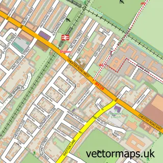
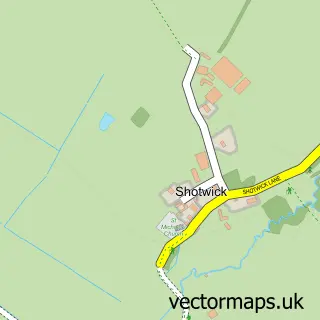
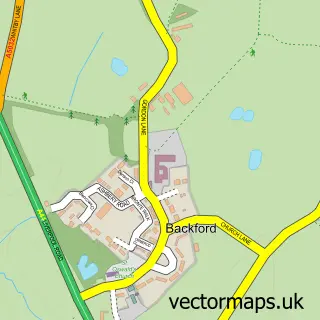
This Saughall street map is a detailed vector street map covering a 750m x 750m area. Select a larger area to create and download your own vector street map of Saughall.
The 750-metre map sample for Saughall covers 519 mapped buildings and approximately 11.3 km of road detail, of which 25 named roads are named. The immediate area includes 1 school, 1 GP surgery within 2 miles and 5 MOT stations within 2 miles. The wider area around Saughall features 1 food and drink venue and 1 campsite within 2 miles. To create a larger or custom map of Saughall, the map builder lets you define your own coverage area and download editable SVG, PDF and PNG files.
Create a larger editable map of Saughall
Choose any area you need and generate a high-quality vector map instantly. Perfect for print, planning, design, business and personal use.

This Saughall street map in Cheshire is available as downloadable SVG, PDF and PNG map files, or as a printed map for planning, business, display, education, local information and design work. You can also create a larger custom map area using the map selector.
What this Saughall map sample shows
Saughall lies within Saughall And Shotwick Park Cp parish, part of Saughall & Mollington ward in the Cheshire West And Chester (B) local authority area. The postcode geography for this area includes the CH postcode area, the CH1 postcode district and the CH1 6 postcode sector. Residents fall under the Nhs Cheshire And Merseyside Integrated Care Board for NHS services.
Local features near Saughall
Within 2 milesAmenities and services in and around Saughall.
Administrative and postcode information for Saughall
Saughall lies within Saughall And Shotwick Park Cp parish, part of Saughall & Mollington ward in the Cheshire West And Chester (B) local authority area. The postcode geography for this area includes the CH postcode area, the CH1 postcode district and the CH1 6 postcode sector. Residents fall under the Nhs Cheshire And Merseyside Integrated Care Board for NHS services.
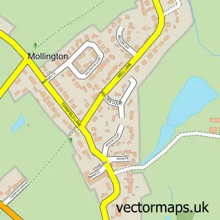
Nearby street map samples around Saughall

More street maps in Cheshire
750 metre map area coverage
Boundary, postcode and point of interest information for the 750m x 750m rectangle centred on this sample map.
Boundaries containing map centre
Constituency: Chester North and Neston Co Const
District: Cheshire West and Chester (B)
Icb: NHS Cheshire and Merseyside ICB
Parish: Saughall and Shotwick Park CP
Police Force: cheshire
Postcode District: CH1
Postcode Sector: CH1 6
Ward: Saughall & Mollington Ward
Nearby boundaries intersecting sample
No additional intersecting boundaries found.
Postcode coverage
POI category counts
Driving School: 5
Dance School: 3
Music School: 3
Beauty Salon: 2
Preschool: 2
Anglican Church: 1
Arts And Entertainment: 1
Atms: 1
Automotive Repair: 1
Beauty And Spa: 1
Sample points of interest
- All Saints Church, Great Saughall
- Magic Rabbit Productions Ltd
- The Cooperative Food (BF) Saughall, Saughall
- Saughall Service Station
- Its chl0
- Hedera Hair
- Kirsty Louise Aesthetics - Chester
- Hope Garden
- Saughall Methodist Church
- Ginger Boutique
- Costa Express
- Rotary Club of Saughall
Create a larger editable map of Saughall
This sample shows only a 750 metre area. To create a larger map of Saughall, use our map builder to choose your own coverage area, add titles and download editable SVG, PDF and PNG files.
Create a custom map of Saughall