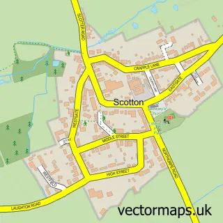
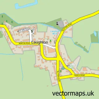
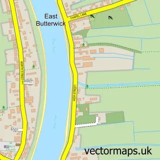
This Scotter street map is a detailed vector street map covering a 750m x 750m area. Select a larger area to create and download your own vector street map of Scotter.
The 750-metre map sample for Scotter covers 612 mapped buildings and approximately 15.6 km of road detail, of which 39 named roads are named. The immediate area includes 1 school and 2 pubs. The wider area around Scotter features 3 food and drink venues and 1 hotel. To create a larger or custom map of Scotter, the map builder lets you define your own coverage area and download editable SVG, PDF and PNG files.
Create a larger editable map of Scotter
Choose any area you need and generate a high-quality vector map instantly. Perfect for print, planning, design, business and personal use.

This Scotter street map in Lincolnshire is available as downloadable SVG, PDF and PNG map files, or as a printed map for planning, business, display, education, local information and design work. You can also create a larger custom map area using the map selector.
What this Scotter map sample shows
Scotter lies within Scotter Cp parish, part of Scotter And Blyton ward in the West Lindsey District local authority area. The postcode geography for this area includes the DN postcode area, the DN21 postcode district and the DN21 3 postcode sector. Residents fall under the Nhs Lincolnshire Integrated Care Board for NHS services.
Local features near Scotter
Within 2 milesAmenities and services in and around Scotter.
Administrative and postcode information for Scotter
Scotter lies within Scotter Cp parish, part of Scotter And Blyton ward in the West Lindsey District local authority area. The postcode geography for this area includes the DN postcode area, the DN21 postcode district and the DN21 3 postcode sector. Residents fall under the Nhs Lincolnshire Integrated Care Board for NHS services.
Nearby street map samples around Scotter

More street maps in Lincolnshire
750 metre map area coverage
Boundary, postcode and point of interest information for the 750m x 750m rectangle centred on this sample map.
Boundaries containing map centre
Constituency: Gainsborough Co Const
County: Lincolnshire County
District: West Lindsey District
Icb: NHS Lincolnshire ICB
Parish: Scotter CP
Police Force: lincolnshire
Postcode District: DN21
Postcode Sector: DN21 3
Ward: Scotter and Blyton Ward
Nearby boundaries intersecting sample
No additional intersecting boundaries found.
Postcode coverage
POI category counts
Convenience Store: 4
Hair Salon: 4
Beauty Salon: 2
Chinese Restaurant: 2
Pub: 2
Assisted Living Facility: 1
Atms: 1
Barber: 1
Beauty And Spa: 1
Bed And Breakfast: 1
Sample points of interest
- The Manor Residential Home
- Lincolnshire Co-op - Scotter
- Myrtle Louisa's FINE Barbering
- EJK Aesthetics
- Forever Young Beauty Salon
- Rookery Aesthetic
- Ivy Lodge
- Scotter Post Office
- Ideal Garage Door Company
- EvoEv
- Tony Arber Butchers
- No Worries Carpet and Floor Cleaning services
Create a larger editable map of Scotter
This sample shows only a 750 metre area. To create a larger map of Scotter, use our map builder to choose your own coverage area, add titles and download editable SVG, PDF and PNG files.
Create a custom map of Scotter