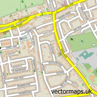
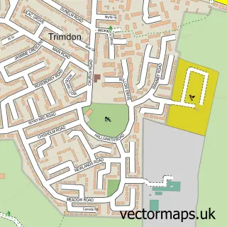
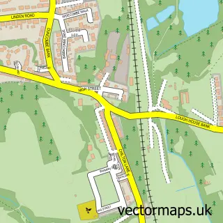
This Sedgefield street map is a detailed vector street map covering a 750m x 750m area. Select a larger area to create and download your own vector street map of Sedgefield.
The 750-metre map sample for Sedgefield covers 351 mapped buildings and approximately 18.5 km of road detail, of which 40 named roads are named. The immediate area includes 1 school, 1 GP surgery, 5 pubs and 2 MOT stations within 2 miles. The wider area around Sedgefield features 1 tourism point of interest, 10 food and drink venues and 1 hotel. To create a larger or custom map of Sedgefield, the map builder lets you define your own coverage area and download editable SVG, PDF and PNG files.
Create a larger editable map of Sedgefield
Choose any area you need and generate a high-quality vector map instantly. Perfect for print, planning, design, business and personal use.

This Sedgefield street map in Durham is available as downloadable SVG, PDF and PNG map files, or as a printed map for planning, business, display, education, local information and design work. You can also create a larger custom map area using the map selector.
What this Sedgefield map sample shows
Sedgefield lies within Sedgefield Cp parish, part of Sedgefield ward in the County Durham local authority area. The postcode geography for this area includes the TS postcode area, the TS21 postcode district and the TS21 3 postcode sector. Residents fall under the Nhs North East And North Cumbria Integrated Care Board for NHS services.
Local features near Sedgefield
Within 2 milesAmenities and services in and around Sedgefield.
Administrative and postcode information for Sedgefield
Sedgefield lies within Sedgefield Cp parish, part of Sedgefield ward in the County Durham local authority area. The postcode geography for this area includes the TS postcode area, the TS21 postcode district and the TS21 3 postcode sector. Residents fall under the Nhs North East And North Cumbria Integrated Care Board for NHS services.
Nearby street map samples around Sedgefield

More street maps in Durham
750 metre map area coverage
Boundary, postcode and point of interest information for the 750m x 750m rectangle centred on this sample map.
Boundaries containing map centre
Constituency: Newton Aycliffe and Spennymoor Co Const
District: County Durham
Icb: NHS North East and North Cumbria ICB
Parish: Sedgefield CP
Police Force: durham
Postcode District: TS21
Postcode Sector: TS21 2
Nearby boundaries intersecting sample
Postcode Sector: TS21 3
Postcode coverage
POI category counts
Doctor: 6
Pub: 5
Bar: 4
Dentist: 4
Flowers And Gifts Shop: 4
Professional Services: 4
Barber: 3
Italian Restaurant: 3
Tea Room: 3
Advertising Agency: 2
Sample points of interest
- Just Out Marketing
- Say Something Consultants
- Sedgefield Medieval Fayre
- PayPoint
- The Cooperative Food (BF) Sedgefield (ERF), Sedgefield
- Lines Valeting North East
- North End Garage
- Bakers Beautique
- The Cake Studio
- Barclays Bank
- Stockton Baptist Church Children's Ministry
- Ceddesfeld Hall
Create a larger editable map of Sedgefield
This sample shows only a 750 metre area. To create a larger map of Sedgefield, use our map builder to choose your own coverage area, add titles and download editable SVG, PDF and PNG files.
Create a custom map of Sedgefield