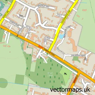
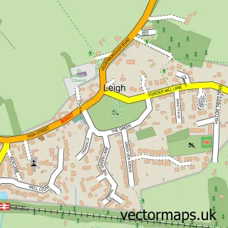
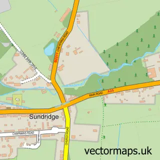
This Sevenoaks Weald street map is a detailed vector street map covering a 750m x 750m area. Select a larger area to create and download your own vector street map of Sevenoaks Weald.
The 750-metre map sample for Sevenoaks Weald covers 209 mapped buildings and approximately 10.6 km of road detail, of which 16 named roads are named. The immediate area includes 1 school, 1 pub and 1 MOT station, with 3 within 2 miles. The wider area around Sevenoaks Weald features 1 tourism point of interest and 1 food and drink venue. To create a larger or custom map of Sevenoaks Weald, the map builder lets you define your own coverage area and download editable SVG, PDF and PNG files.
Create a larger editable map of Sevenoaks Weald
Choose any area you need and generate a high-quality vector map instantly. Perfect for print, planning, design, business and personal use.

This Sevenoaks Weald street map in Kent is available as downloadable SVG, PDF and PNG map files, or as a printed map for planning, business, display, education, local information and design work. You can also create a larger custom map area using the map selector.
What this Sevenoaks Weald map sample shows
Sevenoaks Weald lies within Sevenoaks Weald Cp parish, part of Seal And Weald ward in the Sevenoaks District local authority area. The postcode geography for this area includes the TN postcode area, the TN14 postcode district and the TN14 6 postcode sector. Residents fall under the Nhs Kent And Medway Integrated Care Board for NHS services.
Local features near Sevenoaks Weald
Within 2 milesAmenities and services in and around Sevenoaks Weald.
Administrative and postcode information for Sevenoaks Weald
Sevenoaks Weald lies within Sevenoaks Weald Cp parish, part of Seal And Weald ward in the Sevenoaks District local authority area. The postcode geography for this area includes the TN postcode area, the TN14 postcode district and the TN14 6 postcode sector. Residents fall under the Nhs Kent And Medway Integrated Care Board for NHS services.
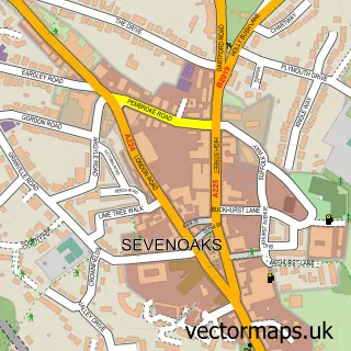
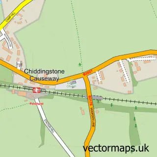
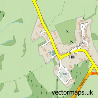
Nearby street map samples around Sevenoaks Weald

More street maps in Kent
750 metre map area coverage
Boundary, postcode and point of interest information for the 750m x 750m rectangle centred on this sample map.
Boundaries containing map centre
Constituency: Sevenoaks Co Const
County: Kent County
District: Sevenoaks District
Icb: NHS Kent and Medway ICB
Parish: Sevenoaks Weald CP
Police Force: kent
Postcode District: TN14
Postcode Sector: TN14 6
Ward: Seal & Weald Ward
Nearby boundaries intersecting sample
No additional intersecting boundaries found.
Postcode coverage
POI category counts
Arts And Entertainment: 2
Plumbing: 2
Scout Hall: 2
Advertising Agency: 1
Construction Services: 1
Contractor: 1
Counseling And Mental Health: 1
Elementary School: 1
European Restaurant: 1
Hair Salon: 1
Sample points of interest
- Rob Robinson Design
- Maureen Carter
- Studiomo
- Edmonds Developments
- Sevenoaks Weald
- Midgley Therapy
- Weald Community Primary School
- The Pavilion Restaurant
- Victor Ralph
- AMO Rings
- Long Barn
- Pure Plumbers
Create a larger editable map of Sevenoaks Weald
This sample shows only a 750 metre area. To create a larger map of Sevenoaks Weald, use our map builder to choose your own coverage area, add titles and download editable SVG, PDF and PNG files.
Create a custom map of Sevenoaks Weald