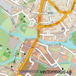
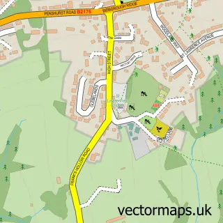
This Leigh street map is a detailed vector street map covering a 750m x 750m area. Select a larger area to create and download your own vector street map of Leigh.
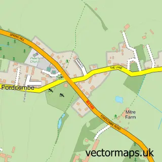
The 750-metre map sample for Leigh covers 251 mapped buildings and approximately 8.9 km of road detail, of which 20 named roads are named. The immediate area includes 1 school, 1 railway station, 1 GP surgery within 2 miles and 2 pubs among other local services. The wider area around Leigh features 1 tourism point of interest and 2 food and drink venues. To create a larger or custom map of Leigh, the map builder lets you define your own coverage area and download editable SVG, PDF and PNG files.
Create a larger editable map of Leigh
Choose any area you need and generate a high-quality vector map instantly. Perfect for print, planning, design, business and personal use.

This Leigh street map in Kent is available as downloadable SVG, PDF and PNG map files, or as a printed map for planning, business, display, education, local information and design work. You can also create a larger custom map area using the map selector.
What this Leigh map sample shows
Leigh lies within Leigh Cp parish, part of Leigh And Chiddingstone Causeway ward in the Sevenoaks District local authority area. The postcode geography for this area includes the TN postcode area, the TN11 postcode district and the TN11 8 postcode sector. Residents fall under the Nhs Kent And Medway Integrated Care Board for NHS services.
Local features near Leigh
Within 2 milesAmenities and services in and around Leigh.
Administrative and postcode information for Leigh
Leigh lies within Leigh Cp parish, part of Leigh And Chiddingstone Causeway ward in the Sevenoaks District local authority area. The postcode geography for this area includes the TN postcode area, the TN11 postcode district and the TN11 8 postcode sector. Residents fall under the Nhs Kent And Medway Integrated Care Board for NHS services.
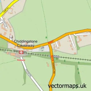
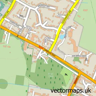
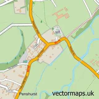
Nearby street map samples around Leigh

More street maps in Kent
750 metre map area coverage
Boundary, postcode and point of interest information for the 750m x 750m rectangle centred on this sample map.
Boundaries containing map centre
Constituency: Tonbridge Co Const
County: Kent County
District: Sevenoaks District
Icb: NHS Kent and Medway ICB
Parish: Leigh CP
Police Force: kent
Postcode District: TN11
Postcode Sector: TN11 8
Ward: Leigh and Chiddingstone Causeway Ward
Nearby boundaries intersecting sample
No additional intersecting boundaries found.
Postcode coverage
POI category counts
Books Mags Music And Video: 2
Pub: 2
Anglican Church: 1
Attractions And Activities: 1
Building Supply Store: 1
Church Cathedral: 1
Community Services Non Profits: 1
Corporate Entertainment Services: 1
Elementary School: 1
Home Improvement Store: 1
Sample points of interest
- Leigh Church
- Leigh in Bloom - Kent
- Leigh Post Office
- Post Office-Leigh
- D S Electrical UK
- St Mary's Church
- 7th Tonbridge Scouts
- The Village Green Stompers Jazz Band
- Leigh Primary School
- LCS Painting and Decorating
- Paula Beresford
- Post Office
Create a larger editable map of Leigh
This sample shows only a 750 metre area. To create a larger map of Leigh, use our map builder to choose your own coverage area, add titles and download editable SVG, PDF and PNG files.
Create a custom map of Leigh