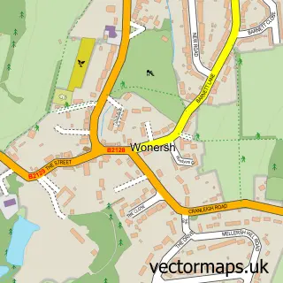
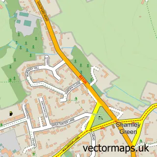
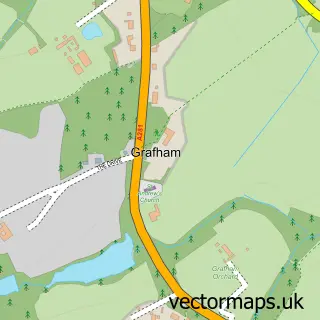
This Shalford street map is a detailed vector street map covering a 750m x 750m area. Select a larger area to create and download your own vector street map of Shalford.
The 750-metre map sample for Shalford covers 335 mapped buildings and approximately 16.1 km of road detail, of which 26 named roads are named. The immediate area includes 1 school, 1 railway station, 3 GP surgeries within 2 miles and 1 pub among other local services. The wider area around Shalford features 3 food and drink venues. To create a larger or custom map of Shalford, the map builder lets you define your own coverage area and download editable SVG, PDF and PNG files.
Create a larger editable map of Shalford
Choose any area you need and generate a high-quality vector map instantly. Perfect for print, planning, design, business and personal use.

This Shalford street map in Surrey is available as downloadable SVG, PDF and PNG map files, or as a printed map for planning, business, display, education, local information and design work. You can also create a larger custom map area using the map selector.
What this Shalford map sample shows
Shalford lies within Shalford Cp parish, part of Shalford ward in the Guildford District (B) local authority area. The postcode geography for this area includes the GU postcode area, the GU4 postcode district and the GU4 8 postcode sector. Residents fall under the Nhs Surrey Heartlands Integrated Care Board for NHS services.
Local features near Shalford
Within 2 milesAmenities and services in and around Shalford.
Administrative and postcode information for Shalford
The local authority covering Shalford is Guildford District (B), within the county of Surrey. The settlement lies within Shalford ward and Shalford Cp civil parish. The GU4 postcode district and GU4 8 postcode sector serve the immediate area. NHS provision in the area is delivered through Royal Surrey County Hospital Nhs Foundation Trust.
Nearby street map samples around Shalford

More street maps in Surrey
750 metre map area coverage
Boundary, postcode and point of interest information for the 750m x 750m rectangle centred on this sample map.
Boundaries containing map centre
Constituency: Godalming and Ash Co Const
County: Surrey County
District: Guildford District (B)
Icb: NHS Surrey and Sussex ICB
Parish: Shalford CP
Police Force: surrey
Postcode District: GU4
Postcode Sector: GU4 8
Ward: Shalford Ward
Nearby boundaries intersecting sample
No additional intersecting boundaries found.
Postcode coverage
POI category counts
Employment Agencies: 3
Barber: 2
Community Services Non Profits: 2
Dance School: 2
Pharmacy: 2
Professional Services: 2
Real Estate Agent: 2
Sports Club And League: 2
Train Station: 2
Warehouses: 2
Sample points of interest
- Shalford Village
- C M Bookkeeping & Payroll
- Orchard Marketing Associates
- PayPoint
- Hepworth Garage
- Moonjive
- 2Mouros Barbers
- Shalford barbers
- Hammonds hair and beauty
- Peacock Beauty Lounge
- Grim's Bikes
- DNW Landscapes
Create a larger editable map of Shalford
This sample shows only a 750 metre area. To create a larger map of Shalford, use our map builder to choose your own coverage area, add titles and download editable SVG, PDF and PNG files.
Create a custom map of Shalford