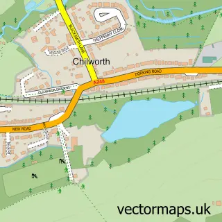
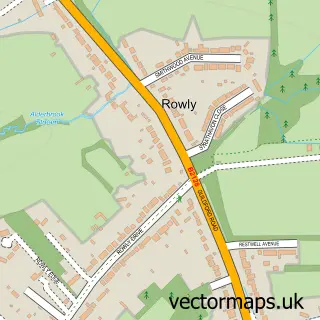
This Bramley street map is a detailed vector street map covering a 750m x 750m area. Select a larger area to create and download your own vector street map of Bramley.
The 750-metre map sample for Bramley covers 360 mapped buildings and approximately 13.0 km of road detail, of which 25 named roads are named. The immediate area includes 1 school, 2 GP surgeries within 2 miles, 2 pubs and 7 MOT stations within 2 miles. The wider area around Bramley features 1 tourism point of interest and 6 food and drink venues. To create a larger or custom map of Bramley, the map builder lets you define your own coverage area and download editable SVG, PDF and PNG files.
Create a larger editable map of Bramley
Choose any area you need and generate a high-quality vector map instantly. Perfect for print, planning, design, business and personal use.

This Bramley street map in Surrey is available as downloadable SVG, PDF and PNG map files, or as a printed map for planning, business, display, education, local information and design work. You can also create a larger custom map area using the map selector.
What this Bramley map sample shows
Bramley lies within Bramley Cp parish, part of Bramley, Busbridge And Hascombe ward in the Waverley District (B) local authority area. The postcode geography for this area includes the GU postcode area, the GU5 postcode district and the GU5 0 postcode sector. Residents fall under the Nhs Surrey Heartlands Integrated Care Board for NHS services.
Local features near Bramley
Within 2 milesAmenities and services in and around Bramley.
Administrative and postcode information for Bramley
The local authority covering Bramley is Waverley District (B), within the county of Surrey. The settlement lies within Bramley, Busbridge And Hascombe ward and Bramley Cp civil parish. The GU5 postcode district and GU5 0 postcode sector serve the immediate area. NHS provision in the area is delivered through Royal Surrey County Hospital Nhs Foundation Trust.
Nearby street map samples around Bramley
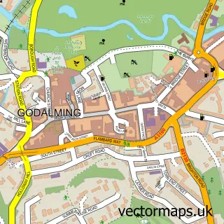

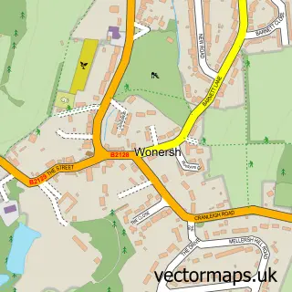
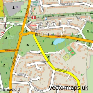
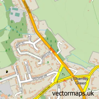
More street maps in Surrey
750 metre map area coverage
Boundary, postcode and point of interest information for the 750m x 750m rectangle centred on this sample map.
Boundaries containing map centre
Constituency: Godalming and Ash Co Const
County: Surrey County
District: Waverley District (B)
Icb: NHS Surrey and Sussex ICB
Parish: Bramley CP
Police Force: surrey
Postcode District: GU5
Postcode Sector: GU5 0
Ward: Bramley & Wonersh Ward
Nearby boundaries intersecting sample
Parish: Wonersh CP
Postcode coverage
POI category counts
Gas Station: 6
Convenience Store: 3
Alternative Medicine: 2
Coffee Shop: 2
Electronics: 2
Gift Shop: 2
Library: 2
Liquor Store: 2
Nail Salon: 2
Pharmacy: 2
Sample points of interest
- Caldwell Penn
- Bigmouth Guildford
- Alternative Options
- Kate Towns NLP & Hypnotherapy
- Holy Trinity, Bramley
- Memories Antiques
- No Naked Walls
- Carers at Home
- Asda (C) Bramley - Horsham Rd PFS
- bramley
- Lloyds Bank
- The Barber Shop & Studio
Create a larger editable map of Bramley
This sample shows only a 750 metre area. To create a larger map of Bramley, use our map builder to choose your own coverage area, add titles and download editable SVG, PDF and PNG files.
Create a custom map of Bramley