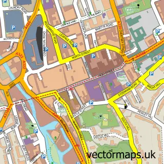
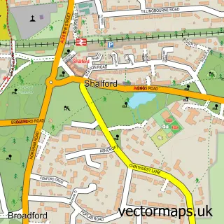
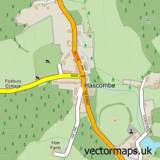
This Wonersh street map is a detailed vector street map covering a 750m x 750m area. Select a larger area to create and download your own vector street map of Wonersh.
The 750-metre map sample for Wonersh covers 247 mapped buildings and approximately 9.3 km of road detail, of which 12 named roads are named. The immediate area includes 1 GP surgery, 2 pubs and 5 MOT stations within 2 miles. The wider area around Wonersh features 1 tourism point of interest and 2 food and drink venues. To create a larger or custom map of Wonersh, the map builder lets you define your own coverage area and download editable SVG, PDF and PNG files.
Create a larger editable map of Wonersh
Choose any area you need and generate a high-quality vector map instantly. Perfect for print, planning, design, business and personal use.

This Wonersh street map in Surrey is available as downloadable SVG, PDF and PNG map files, or as a printed map for planning, business, display, education, local information and design work. You can also create a larger custom map area using the map selector.
What this Wonersh map sample shows
Wonersh lies within Wonersh Cp parish, part of Blackheath And Wonersh ward in the Waverley District (B) local authority area. The postcode geography for this area includes the GU postcode area, the GU5 postcode district and the GU5 0 postcode sector. Residents fall under the Nhs Surrey Heartlands Integrated Care Board for NHS services.
Local features near Wonersh
Within 2 milesAmenities and services in and around Wonersh.
Administrative and postcode information for Wonersh
The local authority covering Wonersh is Waverley District (B), within the county of Surrey. The settlement lies within Blackheath And Wonersh ward and Wonersh Cp civil parish. The GU5 postcode district and GU5 0 postcode sector serve the immediate area. NHS provision in the area is delivered through Royal Surrey County Hospital Nhs Foundation Trust.
Nearby street map samples around Wonersh

More street maps in Surrey
750 metre map area coverage
Boundary, postcode and point of interest information for the 750m x 750m rectangle centred on this sample map.
Boundaries containing map centre
Constituency: Godalming and Ash Co Const
County: Surrey County
District: Waverley District (B)
Icb: NHS Surrey and Sussex ICB
Parish: Wonersh CP
Police Force: surrey
Postcode District: GU5
Postcode Sector: GU5 0
Ward: Bramley & Wonersh Ward
Nearby boundaries intersecting sample
No additional intersecting boundaries found.
Postcode coverage
POI category counts
Professional Services: 4
Church Cathedral: 3
Preschool: 3
Anglican Church: 2
Pub: 2
Shipping Center: 2
Antique Store: 1
Beauty Salon: 1
Building Supply Store: 1
Convenience Store: 1
Sample points of interest
- Wonersh Church
- Wonersh: St John the Baptist
- Debra Charity Shop
- Rosebud Aesthetics
- The Designer Home Company
- St John the Baptist Church
- Wonersh Church
- Wonersh United Reformed Church
- Londis WONERSH VILLAGE STORE
- Hamilton Dance Academy
- Wonersh Surgery
- Neale Richards
Create a larger editable map of Wonersh
This sample shows only a 750 metre area. To create a larger map of Wonersh, use our map builder to choose your own coverage area, add titles and download editable SVG, PDF and PNG files.
Create a custom map of Wonersh