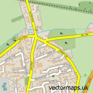
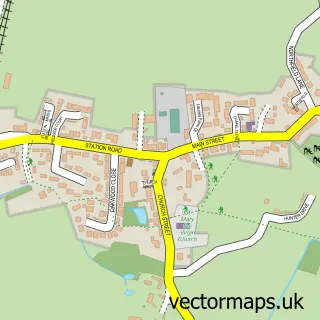
This Sherburn in Elmet street map is a detailed vector street map covering a 750m x 750m area. Select a larger area to create and download your own vector street map of Sherburn in Elmet.
The 750-metre map sample for Sherburn in Elmet covers 565 mapped buildings and approximately 14.6 km of road detail, of which 39 named roads are named. The immediate area includes 1 school, 1 GP surgery, with 2 within 2 miles, 5 pubs and 4 MOT stations within 2 miles. The wider area around Sherburn in Elmet features 8 food and drink venues. To create a larger or custom map of Sherburn in Elmet, the map builder lets you define your own coverage area and download editable SVG, PDF and PNG files.
Create a larger editable map of Sherburn in Elmet
Choose any area you need and generate a high-quality vector map instantly. Perfect for print, planning, design, business and personal use.

This Sherburn in Elmet street map in North Yorkshire is available as downloadable SVG, PDF and PNG map files, or as a printed map for planning, business, display, education, local information and design work. You can also create a larger custom map area using the map selector.
What this Sherburn in Elmet map sample shows
Sherburn in Elmet lies within Sherburn In Elmet Cp parish, part of Sherburn In Elmet ward in the North Yorkshire local authority area. The postcode geography for this area includes the LS postcode area, the LS25 postcode district and the LS25 6 postcode sector. Residents fall under the Nhs Humber And North Yorkshire Integrated Care Board for NHS services.
Local features near Sherburn in Elmet
Within 2 milesAmenities and services in and around Sherburn in Elmet.
Administrative and postcode information for Sherburn in Elmet
Sherburn in Elmet lies within Sherburn In Elmet Cp parish, part of Sherburn In Elmet ward in the North Yorkshire local authority area. The postcode geography for this area includes the LS postcode area, the LS25 postcode district and the LS25 6 postcode sector. Residents fall under the Nhs Humber And North Yorkshire Integrated Care Board for NHS services.
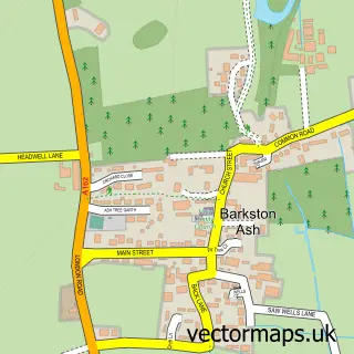
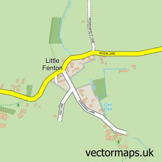
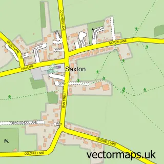
Nearby street map samples around Sherburn in Elmet


More street maps in North Yorkshire
750 metre map area coverage
Boundary, postcode and point of interest information for the 750m x 750m rectangle centred on this sample map.
Boundaries containing map centre
Constituency: Selby Co Const
District: North Yorkshire
Icb: NHS Humber and North Yorkshire ICB
Parish: Sherburn in Elmet CP
Police Force: north yorkshire
Postcode District: LS25
Postcode Sector: LS25 6
Nearby boundaries intersecting sample
No additional intersecting boundaries found.
Postcode coverage
POI category counts
Convenience Store: 6
Hair Salon: 6
Community Center: 5
Pub: 5
Barber: 3
Beauty And Spa: 3
Butcher Shop: 3
Coffee Shop: 3
Funeral Services And Cemeteries: 3
Package Locker: 3
Sample points of interest
- Williamson Towers.
- Child and Co
- Sherburn Bears ARLFC
- Sherburn Eversley Cricket Club
- Ambulance Station
- Accent Property Solutions
- Hilltop Manor Residential Care Home
- Hometune
- G.W.Sissons & Sons Limited
- Crusties
- Penny's Cakes and Bakes
- Elmet Kitchen
Create a larger editable map of Sherburn in Elmet
This sample shows only a 750 metre area. To create a larger map of Sherburn in Elmet, use our map builder to choose your own coverage area, add titles and download editable SVG, PDF and PNG files.
Create a custom map of Sherburn in Elmet