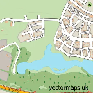
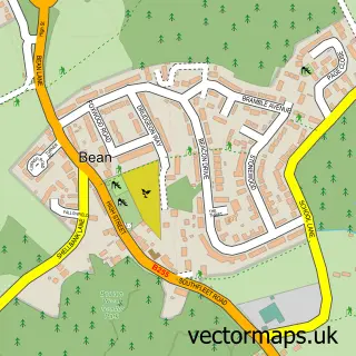
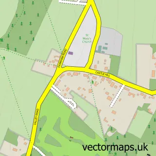
This Southfleet street map is a detailed vector street map covering a 750m x 750m area. Select a larger area to create and download your own vector street map of Southfleet.
The 750-metre map sample for Southfleet covers 143 mapped buildings and approximately 7.7 km of road detail, of which 9 named roads are named. The immediate area includes 1 school, 5 GP surgeries within 2 miles, 1 pub and 1 MOT station, with 7 within 2 miles. The wider area around Southfleet features 2 food and drink venues. To create a larger or custom map of Southfleet, the map builder lets you define your own coverage area and download editable SVG, PDF and PNG files.
Create a larger editable map of Southfleet
Choose any area you need and generate a high-quality vector map instantly. Perfect for print, planning, design, business and personal use.

This Southfleet street map in Kent is available as downloadable SVG, PDF and PNG map files, or as a printed map for planning, business, display, education, local information and design work. You can also create a larger custom map area using the map selector.
What this Southfleet map sample shows
Southfleet lies within Southfleet Cp parish, part of Longfield, New Barn & Southfleet ward in the Dartford District (B) local authority area. The postcode geography for this area includes the DA postcode area, the DA13 postcode district and the DA13 9 postcode sector. Residents fall under the Nhs Kent And Medway Integrated Care Board for NHS services.
Local features near Southfleet
Within 2 milesAmenities and services in and around Southfleet.
Administrative and postcode information for Southfleet
Southfleet lies within Southfleet Cp parish, part of Longfield, New Barn & Southfleet ward in the Dartford District (B) local authority area. The postcode geography for this area includes the DA postcode area, the DA13 postcode district and the DA13 9 postcode sector. Residents fall under the Nhs Kent And Medway Integrated Care Board for NHS services.
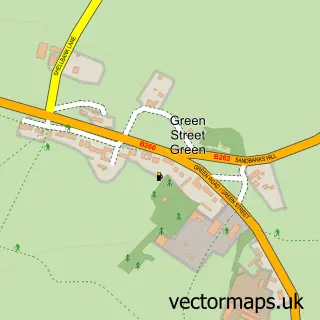
Nearby street map samples around Southfleet

More street maps in Kent
750 metre map area coverage
Boundary, postcode and point of interest information for the 750m x 750m rectangle centred on this sample map.
Boundaries containing map centre
Constituency: Dartford Co Const
County: Kent County
District: Dartford District (B)
Icb: NHS Kent and Medway ICB
Parish: Southfleet CP
Police Force: kent
Postcode District: DA13
Postcode Sector: DA13 9
Ward: Longfield, New Barn & Southfleet Ward
Nearby boundaries intersecting sample
No additional intersecting boundaries found.
Postcode coverage
POI category counts
Anglican Church: 3
Automotive Repair: 2
Advertising Agency: 1
Auto Electrical Repair: 1
Building Supply Store: 1
Business Management Services: 1
Church Cathedral: 1
Community Center: 1
Contractor: 1
Dance School: 1
Sample points of interest
- Prep World
- St Nicholas Church
- St Nicholas's Church
- St. Nicholas at Southfleet
- Macdonald Aerial Co.
- Red Street Garage
- Red Street Garage
- Gold Standard Pest Solutions
- Creative Thinking Printing Services Ltd.
- St Nicholas C of E Church
- Southfleet Village Hall
- W.H Groundworks
Create a larger editable map of Southfleet
This sample shows only a 750 metre area. To create a larger map of Southfleet, use our map builder to choose your own coverage area, add titles and download editable SVG, PDF and PNG files.
Create a custom map of Southfleet