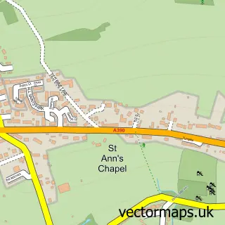
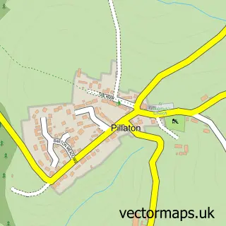
This St Dominic street map is a detailed vector street map covering a 750m x 750m area. Select a larger area to create and download your own vector street map of St Dominic.
The 750-metre map sample for St Dominic covers 151 mapped buildings and approximately 7.7 km of road detail, of which 6 named roads are named. The immediate area includes 1 school, 1 pub and 1 MOT station within 2 miles. The wider area around St Dominic features 1 food and drink venue. To create a larger or custom map of St Dominic, the map builder lets you define your own coverage area and download editable SVG, PDF and PNG files.
Create a larger editable map of St Dominic
Choose any area you need and generate a high-quality vector map instantly. Perfect for print, planning, design, business and personal use.

This St Dominic street map in Cornwall is available as downloadable SVG, PDF and PNG map files, or as a printed map for planning, business, display, education, local information and design work. You can also create a larger custom map area using the map selector.
What this St Dominic map sample shows
St Dominic lies within St. Dominick Cp parish, part of St Dominick, Harrowbarrow And Kelly Bray ward in the Cornwall local authority area. The postcode geography for this area includes the PL postcode area, the PL12 postcode district and the PL12 6 postcode sector. Residents fall under the Nhs Cornwall And The Isles Of Scilly Integrated Care Board for NHS services.
Local features near St Dominic
Within 2 milesAmenities and services in and around St Dominic.
Administrative and postcode information for St Dominic
St Dominic lies within St. Dominick Cp parish, part of St Dominick, Harrowbarrow And Kelly Bray ward in the Cornwall local authority area. The postcode geography for this area includes the PL postcode area, the PL12 postcode district and the PL12 6 postcode sector. Residents fall under the Nhs Cornwall And The Isles Of Scilly Integrated Care Board for NHS services.
Nearby street map samples around St Dominic

More street maps in Cornwall
750 metre map area coverage
Boundary, postcode and point of interest information for the 750m x 750m rectangle centred on this sample map.
Boundaries containing map centre
Constituency: South East Cornwall Co Const
District: Cornwall
Icb: NHS Cornwall and the Isles of Scilly ICB
Parish: St. Dominick CP
Police Force: devon and cornwall
Postcode District: PL12
Postcode Sector: PL12 6
Nearby boundaries intersecting sample
No additional intersecting boundaries found.
Postcode coverage
POI category counts
Post Office: 3
Anglican Church: 1
Antique Store: 1
Cheese Shop: 1
Chimney Sweep: 1
Church Cathedral: 1
Community Center: 1
Elementary School: 1
Engineering Services: 1
Gym: 1
Sample points of interest
- St Dominic: St Dominica
- Trading Boundaries
- Oil in the Raw
- Dave The Chimney Sweep
- St Dominic's Church
- St Dominick Parish Hall
- St Dominic C of E Primary School
- Gym Support
- Westech Sw Ltd. T/a Gymsupport
- HEYL CrossFit
- InPost
- Purrfect Pilates
Create a larger editable map of St Dominic
This sample shows only a 750 metre area. To create a larger map of St Dominic, use our map builder to choose your own coverage area, add titles and download editable SVG, PDF and PNG files.
Create a custom map of St Dominic