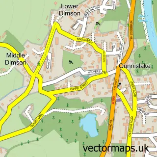
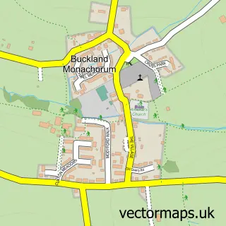
This Calstock street map is a detailed vector street map covering a 750m x 750m area. Select a larger area to create and download your own vector street map of Calstock.
The 750-metre map sample for Calstock covers 225 mapped buildings and approximately 11.9 km of road detail, of which 18 named roads are named. The immediate area includes 1 school, 1 railway station, 3 pubs and 2 MOT stations within 2 miles. The wider area around Calstock features 1 tourism point of interest, 4 food and drink venues and 2 hotels. To create a larger or custom map of Calstock, the map builder lets you define your own coverage area and download editable SVG, PDF and PNG files.
Create a larger editable map of Calstock
Choose any area you need and generate a high-quality vector map instantly. Perfect for print, planning, design, business and personal use.

This Calstock street map in Cornwall is available as downloadable SVG, PDF and PNG map files, or as a printed map for planning, business, display, education, local information and design work. You can also create a larger custom map area using the map selector.
What this Calstock map sample shows
Calstock lies within Calstock Cp parish, part of Gunnislake And Calstock ward in the Cornwall local authority area. The postcode geography for this area includes the PL postcode area, the PL18 postcode district and the PL18 9 postcode sector. Residents fall under the Nhs Cornwall And The Isles Of Scilly Integrated Care Board for NHS services.
Local features near Calstock
Within 2 milesAmenities and services in and around Calstock.
Administrative and postcode information for Calstock
The local authority covering Calstock is Cornwall, within the county of Cornwall. The settlement lies within Gunnislake And Calstock ward and Calstock Cp civil parish. The PL18 postcode district and PL18 9 postcode sector serve the immediate area. NHS provision in the area is delivered through University Hospitals Plymouth Nhs Trust.
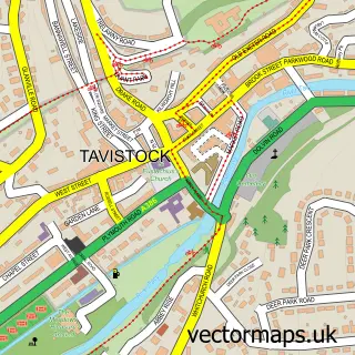
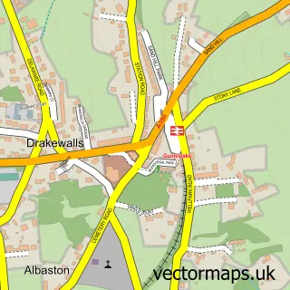
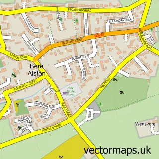
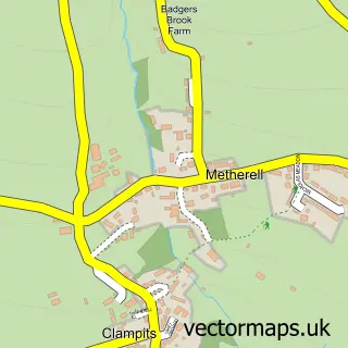
Nearby street map samples around Calstock

More street maps in Cornwall
750 metre map area coverage
Boundary, postcode and point of interest information for the 750m x 750m rectangle centred on this sample map.
Boundaries containing map centre
Constituency: South East Cornwall Co Const
District: Cornwall
Icb: NHS Cornwall and the Isles of Scilly ICB
Parish: Calstock CP
Police Force: devon and cornwall
Postcode District: PL18
Postcode Sector: PL18 9
Nearby boundaries intersecting sample
Constituency: Torridge and Tavistock Co Const
County: Devon County
District: West Devon District (B)
Icb: NHS Devon ICB
Parish: Bere Ferrers CP
Postcode District: PL20
Postcode Sector: PL20 7
Ward: Bere Ferrers Ward
Postcode coverage
POI category counts
Art Gallery: 3
Post Office: 3
Pub: 3
Hotel: 2
Preschool: 2
Self Catering Accommodation: 2
Train Station: 2
Active Life: 1
Alternative Medicine: 1
Auto Electrical Repair: 1
Sample points of interest
- Calstock UK
- Janet Taylor Homeopathy
- Salmagundi Gallery
- Sarah McCormack Ceramics
- The Limekiln Gallery
- Crowle & Scoble
- Willow Cottage Bed And Breakfast
- Calstock Viaduct
- St Andrew's Parish Church
- Lishe Coffee Shop
- Calstock Village Hall
- Calstock Essential Supply Point
Create a larger editable map of Calstock
This sample shows only a 750 metre area. To create a larger map of Calstock, use our map builder to choose your own coverage area, add titles and download editable SVG, PDF and PNG files.
Create a custom map of Calstock