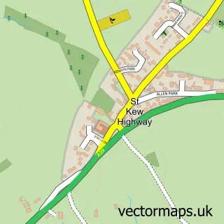
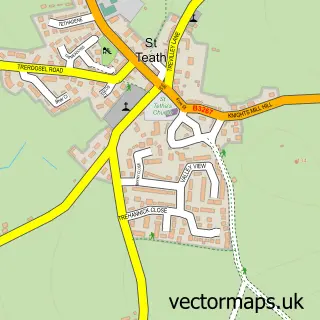
This St Kew street map is a detailed vector street map covering a 750m x 750m area. Select a larger area to create and download your own vector street map of St Kew.
The 750-metre map sample for St Kew covers 40 mapped buildings and approximately 13.0 km of road detail. The immediate area includes 1 school, 1 pub and 1 MOT station within 2 miles. The wider area around St Kew features 1 tourism point of interest, 1 food and drink venue and 3 campsites within 2 miles. To create a larger or custom map of St Kew, the map builder lets you define your own coverage area and download editable SVG, PDF and PNG files.
Create a larger editable map of St Kew
Choose any area you need and generate a high-quality vector map instantly. Perfect for print, planning, design, business and personal use.

This St Kew street map in Cornwall is available as downloadable SVG, PDF and PNG map files, or as a printed map for planning, business, display, education, local information and design work. You can also create a larger custom map area using the map selector.
What this St Kew map sample shows
St Kew lies within St. Kew Cp parish, part of Wadebridge East ward in the Cornwall local authority area. The postcode geography for this area includes the PL postcode area, the PL30 postcode district and the PL30 3 postcode sector. Residents fall under the Nhs Cornwall And The Isles Of Scilly Integrated Care Board for NHS services.
Local features near St Kew
Within 2 milesAmenities and services in and around St Kew.
Administrative and postcode information for St Kew
The local authority covering St Kew is Cornwall, within the county of Cornwall. The settlement lies within Wadebridge East ward and St. Kew Cp civil parish. The PL30 postcode district and PL30 3 postcode sector serve the immediate area. NHS provision in the area is delivered through Royal Cornwall Hospitals Nhs Trust.
Nearby street map samples around St Kew

More street maps in Cornwall
750 metre map area coverage
Boundary, postcode and point of interest information for the 750m x 750m rectangle centred on this sample map.
Boundaries containing map centre
Constituency: North Cornwall Co Const
District: Cornwall
Icb: NHS Cornwall and the Isles of Scilly ICB
Parish: St. Kew CP
Police Force: devon and cornwall
Postcode District: PL30
Postcode Sector: PL30 3
Nearby boundaries intersecting sample
No additional intersecting boundaries found.
Postcode coverage
POI category counts
Anglican Church: 2
Electrician: 1
Elementary School: 1
History Museum: 1
Holiday Rental Home: 1
Pub: 1
Tanning Salon: 1
Sample points of interest
- Saint James the Great Parish Church of St Kew
- St Kew: St James the Great
- Dom Goatman Electrical Services
- St Kew Community Primary School
- St Kew Historical Society
- St Kew Escapes
- St Kew Inn
- Willow Mill
Create a larger editable map of St Kew
This sample shows only a 750 metre area. To create a larger map of St Kew, use our map builder to choose your own coverage area, add titles and download editable SVG, PDF and PNG files.
Create a custom map of St Kew