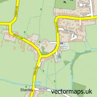
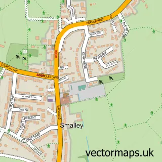
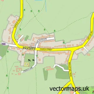
This Stanley Common street map is a detailed vector street map covering a 750m x 750m area. Select a larger area to create and download your own vector street map of Stanley Common.
The 750-metre map sample for Stanley Common covers 273 mapped buildings and approximately 12.6 km of road detail, of which 19 named roads are named. The immediate area includes 1 school, 1 GP surgery within 2 miles and 5 MOT stations within 2 miles. The wider area around Stanley Common features 1 food and drink venue. To create a larger or custom map of Stanley Common, the map builder lets you define your own coverage area and download editable SVG, PDF and PNG files.
Create a larger editable map of Stanley Common
Choose any area you need and generate a high-quality vector map instantly. Perfect for print, planning, design, business and personal use.

This Stanley Common street map in Derbyshire is available as downloadable SVG, PDF and PNG map files, or as a printed map for planning, business, display, education, local information and design work. You can also create a larger custom map area using the map selector.
What this Stanley Common map sample shows
Stanley Common lies within Stanley And Stanley Common Cp parish, part of West Hallam & Dale Abbey ward in the Erewash District (B) local authority area. The postcode geography for this area includes the DE postcode area, the DE7 postcode district and the DE7 6 postcode sector. Residents fall under the Nhs Derby And Derbyshire Integrated Care Board for NHS services.
Local features near Stanley Common
Within 2 milesAmenities and services in and around Stanley Common.
Administrative and postcode information for Stanley Common
Stanley Common lies within Stanley And Stanley Common Cp parish, part of West Hallam & Dale Abbey ward in the Erewash District (B) local authority area. The postcode geography for this area includes the DE postcode area, the DE7 postcode district and the DE7 6 postcode sector. Residents fall under the Nhs Derby And Derbyshire Integrated Care Board for NHS services.
Nearby street map samples around Stanley Common

More street maps in Derbyshire
750 metre map area coverage
Boundary, postcode and point of interest information for the 750m x 750m rectangle centred on this sample map.
Boundaries containing map centre
Constituency: Mid Derbyshire Co Const
County: Derbyshire County
District: Erewash District (B)
Icb: NHS Derby and Derbyshire ICB
Parish: Stanley and Stanley Common CP
Police Force: derbyshire
Postcode District: DE7
Postcode Sector: DE7 6
Ward: West Hallam & Dale Abbey Ward
Nearby boundaries intersecting sample
Constituency: Amber Valley Co Const
District: Amber Valley District (B)
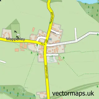
Parish: Mapperley CP, Morley CP
Ward: Little Eaton & Stanley Ward, Smalley, Shipley & Horsley Woodhouse Ward
Postcode coverage
POI category counts
Pet Store: 3
Driving School: 2
Elementary School: 2
Post Office: 2
Business To Business Services: 1
Church Cathedral: 1
Community Center: 1
Currency Exchange: 1
Dance School: 1
Doctor: 1
Sample points of interest
- Banks' Business Solutions
- United Church of All Saints
- The Stanley Common Eventide Hall
- Post Office Travel Money
- Relevation Dance Academy
- Slimming World in Stanley Common
- Stanley Common Driving School
- Stanley Common Driving School
- Stanley Common Primary School
- Stanley Common Primary School
- I B Roofing
- 338 Top Club
Create a larger editable map of Stanley Common
This sample shows only a 750 metre area. To create a larger map of Stanley Common, use our map builder to choose your own coverage area, add titles and download editable SVG, PDF and PNG files.
Create a custom map of Stanley Common