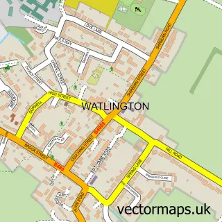
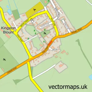
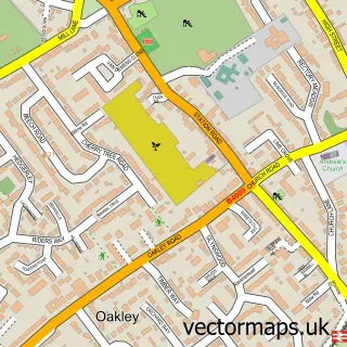
This Stokenchurch street map is a detailed vector street map covering a 750m x 750m area. Select a larger area to create and download your own vector street map of Stokenchurch.
The 750-metre map sample for Stokenchurch covers 266 mapped buildings and approximately 16.4 km of road detail, of which 24 named roads are named. The immediate area includes 1 GP surgery, 4 pubs and 3 MOT stations within 2 miles. The wider area around Stokenchurch features 7 food and drink venues and 2 campsites within 2 miles. To create a larger or custom map of Stokenchurch, the map builder lets you define your own coverage area and download editable SVG, PDF and PNG files.
Create a larger editable map of Stokenchurch
Choose any area you need and generate a high-quality vector map instantly. Perfect for print, planning, design, business and personal use.

This Stokenchurch street map in Buckinghamshire is available as downloadable SVG, PDF and PNG map files, or as a printed map for planning, business, display, education, local information and design work. You can also create a larger custom map area using the map selector.
What this Stokenchurch map sample shows
Stokenchurch lies within Stokenchurch Cp parish, part of Stokenchurch And Radnage ward in the Buckinghamshire local authority area. The postcode geography for this area includes the HP postcode area, the HP14 postcode district and the HP14 3 postcode sector. Residents fall under the Nhs Buckinghamshire, Oxfordshire And Berkshire West Integrated Care Board for NHS services.
Local features near Stokenchurch
Within 2 milesAmenities and services in and around Stokenchurch.
Administrative and postcode information for Stokenchurch
Stokenchurch lies within Stokenchurch Cp parish, part of Stokenchurch And Radnage ward in the Buckinghamshire local authority area. The postcode geography for this area includes the HP postcode area, the HP14 postcode district and the HP14 3 postcode sector. Residents fall under the Nhs Buckinghamshire, Oxfordshire And Berkshire West Integrated Care Board for NHS services.
Nearby street map samples around Stokenchurch

More street maps in Buckinghamshire
750 metre map area coverage
Boundary, postcode and point of interest information for the 750m x 750m rectangle centred on this sample map.
Boundaries containing map centre
Constituency: Mid Buckinghamshire Co Const
District: Buckinghamshire
Icb: NHS Thames Valley ICB
Parish: Stokenchurch CP
Police Force: thames valley
Postcode District: HP14
Postcode Sector: HP14 3
Ward: Ridgeway West Ward
Nearby boundaries intersecting sample
No additional intersecting boundaries found.
Postcode coverage
POI category counts
It Service And Computer Repair: 5
Contractor: 4
Pub: 4
Hair Salon: 3
Musician: 3
Real Estate Agent: 3
Advertising Agency: 2
Bar: 2
Building Supply Store: 2
Construction Services: 2
Sample points of interest
- Creative Sound Design Limited
- Tank 2 Create
- Stokenchurch SS Peter and Paul
- Easely does it
- Stokenchurch: Alpha ear clinic ,Microsuction Ear Wax Removal
- Holly Coachworks
- Lloyds Bank
- Royal Oak
- Woody’s Bar
- Allnutt Transport
- Tec Glass
- Chiltern Technical Services Limited
Create a larger editable map of Stokenchurch
This sample shows only a 750 metre area. To create a larger map of Stokenchurch, use our map builder to choose your own coverage area, add titles and download editable SVG, PDF and PNG files.
Create a custom map of Stokenchurch