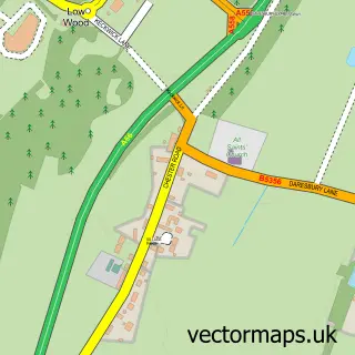
This Stretton street map is a detailed vector street map covering a 750m x 750m area. Select a larger area to create and download your own vector street map of Stretton.
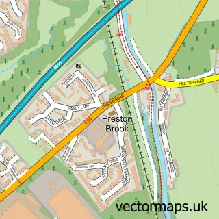
The 750-metre map sample for Stretton covers 120 mapped buildings and approximately 8.0 km of road detail, of which 10 named roads are named. The immediate area includes 1 school, 1 GP surgery, 1 pub and 2 MOT stations within 2 miles. The wider area around Stretton features 1 tourism point of interest, 1 food and drink venue and 4 hotels. To create a larger or custom map of Stretton, the map builder lets you define your own coverage area and download editable SVG, PDF and PNG files.
Create a larger editable map of Stretton
Choose any area you need and generate a high-quality vector map instantly. Perfect for print, planning, design, business and personal use.

This Stretton street map in Cheshire is available as downloadable SVG, PDF and PNG map files, or as a printed map for planning, business, display, education, local information and design work. You can also create a larger custom map area using the map selector.
What this Stretton map sample shows
Stretton lies within Stretton Cp parish, part of Appleton ward in the Warrington (B) local authority area. The postcode geography for this area includes the WA postcode area, the WA4 postcode district and the WA4 5 postcode sector. Residents fall under the Nhs Cheshire And Merseyside Integrated Care Board for NHS services.
Local features near Stretton
Within 2 milesAmenities and services in and around Stretton.
Administrative and postcode information for Stretton
Stretton lies within Stretton Cp parish, part of Appleton ward in the Warrington (B) local authority area. The postcode geography for this area includes the WA postcode area, the WA4 postcode district and the WA4 5 postcode sector. Residents fall under the Nhs Cheshire And Merseyside Integrated Care Board for NHS services.
Nearby street map samples around Stretton

More street maps in Cheshire
750 metre map area coverage
Boundary, postcode and point of interest information for the 750m x 750m rectangle centred on this sample map.
Boundaries containing map centre
Constituency: Warrington South Co Const
District: Warrington (B)
Icb: NHS Cheshire and Merseyside ICB
Parish: Stretton CP
Police Force: cheshire
Postcode District: WA4
Postcode Sector: WA4 4
Ward: Appleton Ward
Nearby boundaries intersecting sample
Parish: Appleton CP, Hatton CP
Postcode Sector: WA4 5
Postcode coverage
POI category counts
Doctor: 5
Hotel: 4
Resort: 4
Orthopedist: 3
Anglican Church: 2
Elementary School: 2
Home Service: 2
Medical Center: 2
Naturopathic Holistic: 2
Alternative Medicine: 1
Sample points of interest
- Natalia Kerkham
- Spooky World
- St Matthew
- St Matthews Church, Stretton
- Thyme To Heal - Holistic Therapies
- JL Vans
- The Cheshire Skin & Beauty Clinic
- The School House
- Neo Car Sales
- St Cross C of E Church
- Spire Cheshire Hospital
- Stretton Private Day Nursery
Create a larger editable map of Stretton
This sample shows only a 750 metre area. To create a larger map of Stretton, use our map builder to choose your own coverage area, add titles and download editable SVG, PDF and PNG files.
Create a custom map of Stretton