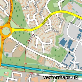
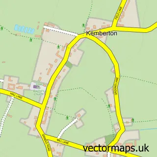
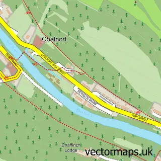
This Telford street map is a detailed vector street map covering a 750m x 750m area. Select a larger area to create and download your own vector street map of Telford.
The 750-metre map sample for Telford covers 65 mapped buildings and approximately 16.0 km of road detail, of which 13 named roads are named. The immediate area includes 5 GP surgeries within 2 miles, 1 pub and 1 MOT station, with 16 within 2 miles. The wider area around Telford features 19 food and drink venues and 6 hotels. To create a larger or custom map of Telford, the map builder lets you define your own coverage area and download editable SVG, PDF and PNG files.
Create a larger editable map of Telford
Choose any area you need and generate a high-quality vector map instantly. Perfect for print, planning, design, business and personal use.

This Telford street map in Shropshire is available as downloadable SVG, PDF and PNG map files, or as a printed map for planning, business, display, education, local information and design work. You can also create a larger custom map area using the map selector.
What this Telford map sample shows
Telford lies within Lawley And Overdale Cp parish, part of Ketley & Overdale ward in the Telford And Wrekin (B) local authority area. Residents fall under the Nhs Shropshire, Telford And Wrekin Integrated Care Board for NHS services.
Local features near Telford
Within 2 milesAmenities and services in and around Telford.
Administrative and postcode information for Telford
Telford lies within Lawley And Overdale Cp parish, part of Ketley & Overdale ward in the Telford And Wrekin (B) local authority area. Residents fall under the Nhs Shropshire, Telford And Wrekin Integrated Care Board for NHS services.
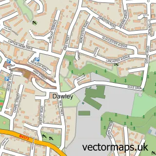
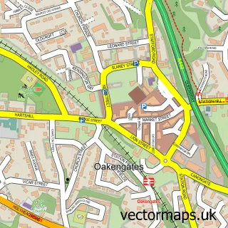
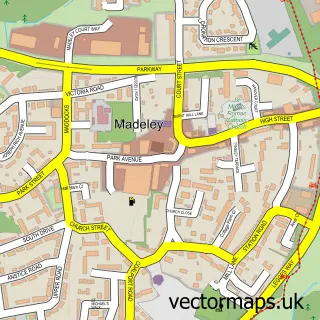
Nearby street map samples around Telford

More street maps in Shropshire
750 metre map area coverage
Boundary, postcode and point of interest information for the 750m x 750m rectangle centred on this sample map.
Boundaries containing map centre
Constituency: Telford Boro Const
District: Telford and Wrekin (B)
Icb: NHS Shropshire Telford and Wrekin ICB
Parish: Lawley and Overdale CP
Police Force: west mercia
Postcode District: TF3
Postcode Sector: TF3 4
Ward: Malinslee & Dawley Bank Ward
Nearby boundaries intersecting sample
Parish: Great Dawley CP
Postcode Sector: TF3 2
Postcode coverage
POI category counts
Clothing Store: 27
Jewelry Store: 11
Mobile Phone Store: 11
Bank Credit Union: 10
Coffee Shop: 9
Shoe Store: 9
Childrens Clothing Store: 8
Employment Agencies: 8
Cafe: 7
Cosmetic And Beauty Supplies: 6
Sample points of interest
- Kare Plus
- Turas Accountants Ltd
- Flip Out Telford
- M A T M
- Marketing at The Mill Ltd.
- Keith Gullis Curative Hypnotherapy
- Keith Gullis Curative Hypnotherapy
- Castle Galleries Telford
- John Silver Fine Arts
- Hobbycraft
- Wagamama
- Cashpoint® 113 The Border
Create a larger editable map of Telford
This sample shows only a 750 metre area. To create a larger map of Telford, use our map builder to choose your own coverage area, add titles and download editable SVG, PDF and PNG files.
Create a custom map of Telford