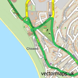
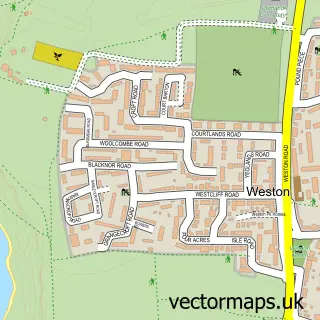
This The Grove street map is a detailed vector street map covering a 750m x 750m area. Select a larger area to create and download your own vector street map of The Grove.
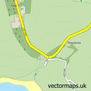
The 750-metre map sample for The Grove covers 145 mapped buildings and approximately 7.2 km of road detail, of which 8 named roads are named. The immediate area includes 1 GP surgery within 2 miles and 4 MOT stations within 2 miles. The wider area around The Grove features 2 tourism points of interest, 2 food and drink venues and 2 hotels. To create a larger or custom map of The Grove, the map builder lets you define your own coverage area and download editable SVG, PDF and PNG files.
Create a larger editable map of The Grove
Choose any area you need and generate a high-quality vector map instantly. Perfect for print, planning, design, business and personal use.

This The Grove street map in Dorset is available as downloadable SVG, PDF and PNG map files, or as a printed map for planning, business, display, education, local information and design work. You can also create a larger custom map area using the map selector.
What this The Grove map sample shows
The Grove lies within Portland Cp parish, part of Portland ward in the Dorset local authority area. The postcode geography for this area includes the DT postcode area, the DT5 postcode district and the DT5 1 postcode sector. Residents fall under the Nhs Dorset Integrated Care Board for NHS services.
Local features near The Grove
Within 2 milesAmenities and services in and around The Grove.
Administrative and postcode information for The Grove
The Grove lies within Portland Cp parish, part of Portland ward in the Dorset local authority area. The postcode geography for this area includes the DT postcode area, the DT5 postcode district and the DT5 1 postcode sector. Residents fall under the Nhs Dorset Integrated Care Board for NHS services.
Nearby street map samples around The Grove

More street maps in Dorset
750 metre map area coverage
Boundary, postcode and point of interest information for the 750m x 750m rectangle centred on this sample map.
Boundaries containing map centre
Constituency: South Dorset Co Const
District: Dorset
Icb: NHS Dorset ICB
Parish: Portland CP
Police Force: dorset
Postcode District: DT5
Postcode Sector: DT5 1
Ward: Portland Ward
Nearby boundaries intersecting sample
No additional intersecting boundaries found.
Postcode coverage
POI category counts
Building Supply Store: 2
Church Cathedral: 2
Hotel: 2
Jail And Prison: 2
Restaurant: 2
Attractions And Activities: 1
Bar: 1
Charity Organization: 1
Computer Wholesaler: 1
Elementary School: 1
Sample points of interest
- Lottie Larder - Portland
- The Breakwater Bar
- Funny Face Entertainments
- Jones the Pipe
- Expia Limited
- Church of Our Lady and St Andrew, Portland
- St Peter's Church, Portland
- Combens
- Grove Infant School
- Jurassic Oven and Domestic Cleaning
- Clifton Hotel
- The Clifton Hotel
Create a larger editable map of The Grove
This sample shows only a 750 metre area. To create a larger map of The Grove, use our map builder to choose your own coverage area, add titles and download editable SVG, PDF and PNG files.
Create a custom map of The Grove