Vector Maps logo
Home Why it works Popular maps Districts Samples Customizer Create Your Map
VectorMaps.uk
Home Popular maps Districts Samples Customizer Create Your Map Privacy Disclaimer
Home / UK Maps / East Lothian / Tranent Map

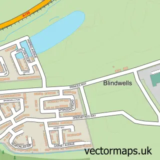
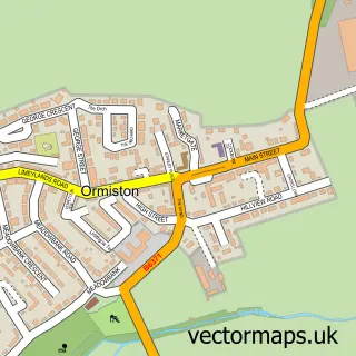
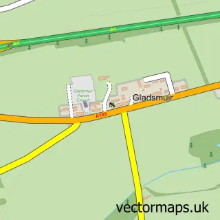
This Tranent street map is a detailed vector street map covering a 750m x 750m area. Select a larger area to create and download your own vector street map of Tranent.

Tranent is a town in East Lothian, in the South Scotland of Scotland. The settlement falls within the East Lothian parliamentary constituency. It is served by the EH33 postcode district, with EH33 1 as the local postcode sector.

The 750-metre map sample for Tranent covers 387 mapped buildings and approximately 20.3 km of road detail, of which 46 named roads are named. The immediate area includes 1 GP surgery, with 3 within 2 miles, 4 pubs and 2 MOT stations, with 10 within 2 miles. The wider area around Tranent features 4 tourism points of interest, 11 food and drink venues and 1 hotel. To create a larger or custom map of Tranent, the map builder lets you define your own coverage area and download editable SVG, PDF and PNG files.

387Buildings
20.28 kmRoads
46Named roads
0Residents within 2 miles
Create your own

Create a larger editable map of Tranent

Choose any area you need and generate a high-quality vector map instantly. Perfect for print, planning, design, business and personal use.

Choose any location
Editable SVG files
Any size up to A0
PDF, PNG & more
Instant download
High quality guaranteed
Create My Custom Map
Secure, private & no credit card required
Tranent Vector Street Map
750m Sample
Tranent vector street map sample showing roads, buildings and local features in a 750 metre preview area
Buy Tranent Map Print from £12.95 Buy Tranent Digital Map from £6

This Tranent street map in East Lothian is available as downloadable SVG, PDF and PNG map files, or as a printed map for planning, business, display, education, local information and design work. You can also create a larger custom map area using the map selector.

What this Tranent map sample shows

Tranent lies within East Lothian parish, part of Tranent, Wallyford And Macmerry ward in the East Lothian local authority area. The postcode geography for this area includes the EH postcode area, the EH33 postcode district and the EH33 1 postcode sector. Residents fall under the Lothian for NHS services.

Local features near Tranent

Within 2 miles

Amenities and services in and around Tranent.

1 GP surgeries 3 within 2 miles
2 MOT stations 10 within 2 miles
4 Tourism & leisure
11 Food & drink
4 Pubs
1 Hotels
9 Healthcare POIs
4 Vehicle services

Counts are approximate and based on publicly available data.

Administrative and postcode information for Tranent

Tranent lies within East Lothian parish, part of Tranent, Wallyford And Macmerry ward in the East Lothian local authority area. The postcode geography for this area includes the EH postcode area, the EH33 postcode district and the EH33 1 postcode sector. Residents fall under the Lothian for NHS services.

Parish EAST LOTHIAN
Ward Tranent, Wallyford and Macmerry
District / local authority East Lothian
County East Lothian
Historic county East Lothian
Postcode district EH33
Postcode sector EH33 1
Parliamentary constituency East Lothian
Region South Scotland
Country Scotland

Nearby street map samples around Tranent

Street map sample of Edinburgh, City of Edinburgh Edinburgh City - City of Edinburgh - 9.1 miles Street map sample of Blindwells, East Lothian Blindwells Village - East Lothian - 0.9 miles Street map sample of Elphinstone, East Lothian Elphinstone Village - East Lothian - 1.6 miles Street map sample of New Winton, East Lothian New Winton Village - East Lothian - 1.7 miles Street map sample of Macmerry, East Lothian Macmerry Village - East Lothian - 1.8 miles Street map sample of Ormiston, East Lothian Ormiston Village - East Lothian - 2.2 miles Street map sample of Wallyford, East Lothian Wallyford Village - East Lothian - 2.5 miles Street map sample of Longniddry Village, East Lothian Longniddry Village Village - East Lothian - 3.1 miles Street map sample of Cousland, Midlothian Cousland Village - Midlothian - 3.3 miles Street map sample of Gladsmuir, East Lothian Gladsmuir Village - East Lothian - 3.3 miles

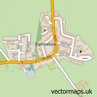
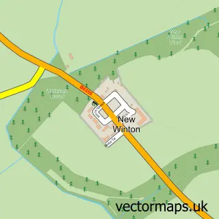
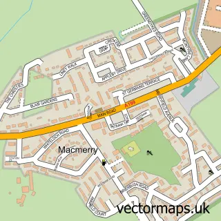
More street maps in East Lothian

Street map sample of Blindwells, East Lothian Blindwells Village - 0.9 miles Street map sample of Prestonpans, East Lothian Prestonpans Town - 1.6 miles Street map sample of Elphinstone, East Lothian Elphinstone Village - 1.6 miles Street map sample of New Winton, East Lothian New Winton Village - 1.7 miles Street map sample of Macmerry, East Lothian Macmerry Village - 1.8 miles

750 metre map area coverage

Boundary, postcode and point of interest information for the 750m x 750m rectangle centred on this sample map.

Boundaries containing map centre

Constituency: Lothian East Co Const

District: East Lothian

Icb: Lothian

Postcode District: EH33

Postcode Sector: EH33 1

Ward: Tranent, Wallyford and Macmerry Ward

Nearby boundaries intersecting sample

Postcode Sector: EH33 2

Postcode coverage

EH33 EH33 1 EH33 2

POI category counts

Beauty Salon: 12

Hair Salon: 8

Convenience Store: 7

Professional Services: 6

Barber: 5

Beauty And Spa: 5

Fast Food Restaurant: 5

Pharmacy: 5

Automotive Repair: 4

Funeral Services And Cemeteries: 4

Sample points of interest

  • White Domestics Appliance Repair Service
  • Home Zone Arts And Crafts
  • ATM (Post Office) Atms
  • Day Today Atms
  • PayPoint Atms
  • Lothian Road Rescue Automotive
  • Reilly Service Centre Automotive
  • Reno Car Care Automotive
  • Autoworx motor services Automotive Repair
  • Dunwell Motor Group Automotive Repair
  • G B Autoservices Automotive Repair
  • R Reilly Service Centre Automotive Repair

Create a larger editable map of Tranent

This sample shows only a 750 metre area. To create a larger map of Tranent, use our map builder to choose your own coverage area, add titles and download editable SVG, PDF and PNG files.

Create a custom map of Tranent

Phone 01751 473136 | Copyright Vectormaps.uk 2026

Samples Customizer Privacy Disclaimer
Tranent Vector Street Map
Tranent enlarged street map sample showing a 750 metre preview area