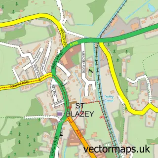
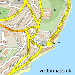
This Tywardreath street map is a detailed vector street map covering a 750m x 750m area. Select a larger area to create and download your own vector street map of Tywardreath.
The 750-metre map sample for Tywardreath covers 339 mapped buildings and approximately 15.1 km of road detail, of which 24 named roads are named. The immediate area includes 1 GP surgery within 2 miles, 1 pub and 1 MOT station, with 4 within 2 miles. The wider area around Tywardreath features 1 food and drink venue and 2 campsites within 2 miles. To create a larger or custom map of Tywardreath, the map builder lets you define your own coverage area and download editable SVG, PDF and PNG files.
Create a larger editable map of Tywardreath
Choose any area you need and generate a high-quality vector map instantly. Perfect for print, planning, design, business and personal use.

This Tywardreath street map in Cornwall is available as downloadable SVG, PDF and PNG map files, or as a printed map for planning, business, display, education, local information and design work. You can also create a larger custom map area using the map selector.
What this Tywardreath map sample shows
Tywardreath lies within Tywardreath And Par Cp parish, part of Fowey And Tywardreath ward in the Cornwall local authority area. The postcode geography for this area includes the PL postcode area, the PL24 postcode district and the PL24 2 postcode sector. Residents fall under the Nhs Cornwall And The Isles Of Scilly Integrated Care Board for NHS services.
Local features near Tywardreath
Within 2 milesAmenities and services in and around Tywardreath.
Administrative and postcode information for Tywardreath
Tywardreath lies within Tywardreath And Par Cp parish, part of Fowey And Tywardreath ward in the Cornwall local authority area. The postcode geography for this area includes the PL postcode area, the PL24 postcode district and the PL24 2 postcode sector. Residents fall under the Nhs Cornwall And The Isles Of Scilly Integrated Care Board for NHS services.
Nearby street map samples around Tywardreath


More street maps in Cornwall
750 metre map area coverage
Boundary, postcode and point of interest information for the 750m x 750m rectangle centred on this sample map.
Boundaries containing map centre
Constituency: St. Austell and Newquay Co Const
District: Cornwall
Icb: NHS Cornwall and the Isles of Scilly ICB
Parish: Tywardreath and Par CP
Police Force: devon and cornwall
Postcode District: PL24
Postcode Sector: PL24 2
Nearby boundaries intersecting sample
No additional intersecting boundaries found.
Postcode coverage
POI category counts
Convenience Store: 3
Key And Locksmith: 3
Hair Salon: 2
Scout Hall: 2
Anglican Church: 1
Bakery: 1
Bed And Breakfast: 1
Butcher Shop: 1
Church Cathedral: 1
Community Services Non Profits: 1
Sample points of interest
- Tywardreath: St Andrew with Tregaminion
- The Village Bakery
- Elmswood House
- Tywardreath Butchers
- The Parish Church of Saint Andrew the Apostle
- Pendennis Masonic Lodge, Cornwall, UK
- Londis
- Premier
- Tywardreath Shop
- Trenython Luxury Cottages
- Lou's Top Dog Training
- Johns Hair Studio
Create a larger editable map of Tywardreath
This sample shows only a 750 metre area. To create a larger map of Tywardreath, use our map builder to choose your own coverage area, add titles and download editable SVG, PDF and PNG files.
Create a custom map of Tywardreath