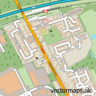
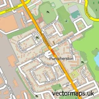
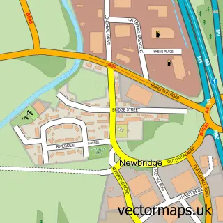
This Uphall street map is a detailed vector street map covering a 750m x 750m area. Select a larger area to create and download your own vector street map of Uphall.
The 750-metre map sample for Uphall covers 491 mapped buildings and approximately 18.3 km of road detail, of which 31 named roads are named. The immediate area includes 3 GP surgeries within 2 miles, 2 pubs and 2 MOT stations, with 11 within 2 miles. The wider area around Uphall features 5 food and drink venues. To create a larger or custom map of Uphall, the map builder lets you define your own coverage area and download editable SVG, PDF and PNG files.
Create a larger editable map of Uphall
Choose any area you need and generate a high-quality vector map instantly. Perfect for print, planning, design, business and personal use.

This Uphall street map in West Lothian is available as downloadable SVG, PDF and PNG map files, or as a printed map for planning, business, display, education, local information and design work. You can also create a larger custom map area using the map selector.
What this Uphall map sample shows
Uphall lies within West Lothian parish, part of Broxburn, Uphall And Winchburgh ward in the West Lothian local authority area. The postcode geography for this area includes the EH postcode area, the EH52 postcode district and the EH52 5 postcode sector. Residents fall under the Lothian for NHS services.
Local features near Uphall
Within 2 milesAmenities and services in and around Uphall.
Administrative and postcode information for Uphall
The local authority covering Uphall is West Lothian, within the county of West Lothian. The settlement lies within Broxburn, Uphall And Winchburgh ward and West Lothian civil parish. The EH52 postcode district and EH52 5 postcode sector serve the immediate area. NHS provision in the area is delivered through Lothian.
Nearby street map samples around Uphall

More street maps in West Lothian
750 metre map area coverage
Boundary, postcode and point of interest information for the 750m x 750m rectangle centred on this sample map.
Boundaries containing map centre
Constituency: Livingston Co Const
District: West Lothian
Icb: Lothian
Postcode District: EH52
Postcode Sector: EH52 5
Ward: Broxburn, Uphall and Winchburgh Ward
Nearby boundaries intersecting sample
Postcode Sector: EH52 6
Postcode coverage
POI category counts
Beauty Salon: 4
Chiropractor: 3
Dentist: 3
Fast Food Restaurant: 3
Atms: 2
Automotive: 2
Automotive Repair: 2
Beauty And Spa: 2
Building Supply Store: 2
Business Manufacturing And Supply: 2
Sample points of interest
- Middleton Hall Care Home
- Lifestyle Express, Uphall
- Scotmid - Uphall 0166, Uphall
- ABC Hearing Ltd.
- Brian Anderson's Car Valeting
- Geoliving
- Arnold Clark Automobiles Ltd.
- Arnold Clark Broxburn SEAT / Fiat / Abarth
- Arnold Clark
- CRS Garage and MOT Centre
- The Wee Barber Shop
- Exhibit studios
Create a larger editable map of Uphall
This sample shows only a 750 metre area. To create a larger map of Uphall, use our map builder to choose your own coverage area, add titles and download editable SVG, PDF and PNG files.
Create a custom map of Uphall