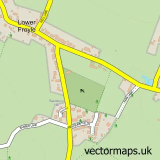
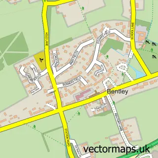
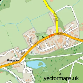
This Upper Froyle street map is a detailed vector street map covering a 750m x 750m area. Select a larger area to create and download your own vector street map of Upper Froyle.
The 750-metre map sample for Upper Froyle covers 110 mapped buildings and approximately 13.3 km of road detail, of which 6 named roads are named. The immediate area includes 1 MOT station within 2 miles. To create a larger or custom map of Upper Froyle, the map builder lets you define your own coverage area and download editable SVG, PDF and PNG files.
Create a larger editable map of Upper Froyle
Choose any area you need and generate a high-quality vector map instantly. Perfect for print, planning, design, business and personal use.

This Upper Froyle street map in Hampshire is available as downloadable SVG, PDF and PNG map files, or as a printed map for planning, business, display, education, local information and design work. You can also create a larger custom map area using the map selector.
What this Upper Froyle map sample shows
Upper Froyle lies within Froyle Cp parish, part of Bentworth & Froyle ward in the East Hampshire District local authority area. The postcode geography for this area includes the GU postcode area, the GU34 postcode district and the GU34 4 postcode sector. Residents fall under the Nhs Hampshire And Isle Of Wight Integrated Care Board for NHS services.
Local features near Upper Froyle
Within 2 milesAmenities and services in and around Upper Froyle.
Administrative and postcode information for Upper Froyle
Upper Froyle lies within Froyle Cp parish, part of Bentworth & Froyle ward in the East Hampshire District local authority area. The postcode geography for this area includes the GU postcode area, the GU34 postcode district and the GU34 4 postcode sector. Residents fall under the Nhs Hampshire And Isle Of Wight Integrated Care Board for NHS services.
Nearby street map samples around Upper Froyle

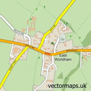
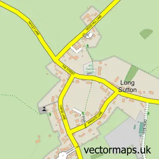
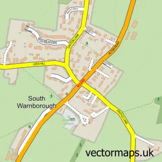
More street maps in Hampshire
750 metre map area coverage
Boundary, postcode and point of interest information for the 750m x 750m rectangle centred on this sample map.
Boundaries containing map centre
Constituency: East Hampshire Co Const
County: Hampshire County
District: East Hampshire District
Icb: NHS Hampshire and Isle of Wight ICB
Parish: Froyle CP
Police Force: hampshire
Postcode District: GU34
Postcode Sector: GU34 4
Ward: Bentworth & Froyle Ward
Nearby boundaries intersecting sample
No additional intersecting boundaries found.
Postcode coverage
POI category counts
Active Life: 1
Anglican Church: 1
Architectural Designer: 1
Arts And Entertainment: 1
Automotive Repair: 1
Church Cathedral: 1
Convenience Store: 1
Driving School: 1
Employment Agencies: 1
Ev Charging Station: 1
Sample points of interest
- Selbourne Zig Zag
- The Assumption of the Blessed Virgin Mary, Froyle
- Macallan Penfold
- Upper Froyle
- Rawles Motorsport
- St Mary's Church
- SPAR - Alton
- Jason richards school of motoring
- C 2 C Recruitment
- Roam EV Charging Station
- Hen & Chicken Filling Station
- Wag Design Ltd
Create a larger editable map of Upper Froyle
This sample shows only a 750 metre area. To create a larger map of Upper Froyle, use our map builder to choose your own coverage area, add titles and download editable SVG, PDF and PNG files.
Create a custom map of Upper Froyle