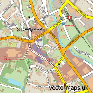
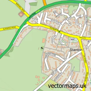
This Walsham le Willows street map is a detailed vector street map covering a 750m x 750m area. Select a larger area to create and download your own vector street map of Walsham le Willows.
The 750-metre map sample for Walsham le Willows covers 254 mapped buildings and approximately 11.1 km of road detail, of which 12 named roads are named. The immediate area includes 2 pubs and 3 MOT stations within 2 miles. The wider area around Walsham le Willows features 2 food and drink venues. To create a larger or custom map of Walsham le Willows, the map builder lets you define your own coverage area and download editable SVG, PDF and PNG files.
Create a larger editable map of Walsham le Willows
Choose any area you need and generate a high-quality vector map instantly. Perfect for print, planning, design, business and personal use.

This Walsham le Willows street map in Suffolk is available as downloadable SVG, PDF and PNG map files, or as a printed map for planning, business, display, education, local information and design work. You can also create a larger custom map area using the map selector.
What this Walsham le Willows map sample shows
Walsham le Willows lies within Walsham-Le-Willows Cp parish, part of Walsham-Le-Willows ward in the Mid Suffolk District local authority area. The postcode geography for this area includes the IP postcode area, the IP31 postcode district and the IP31 3 postcode sector. Residents fall under the Nhs Suffolk And North East Essex Integrated Care Board for NHS services.
Local features near Walsham le Willows
Within 2 milesAmenities and services in and around Walsham le Willows.
Administrative and postcode information for Walsham le Willows
The local authority covering Walsham le Willows is Mid Suffolk District, within the county of Suffolk. The settlement lies within Walsham-Le-Willows ward and Walsham-Le-Willows Cp civil parish. The IP31 postcode district and IP31 3 postcode sector serve the immediate area. NHS provision in the area is delivered through West Suffolk Nhs Foundation Trust.
Nearby street map samples around Walsham le Willows


More street maps in Suffolk
750 metre map area coverage
Boundary, postcode and point of interest information for the 750m x 750m rectangle centred on this sample map.
Boundaries containing map centre
Constituency: Waveney Valley Co Const
County: Suffolk County
District: Mid Suffolk District
Icb: NHS Essex ICB
Parish: Walsham-le-Willows CP
Police Force: suffolk
Postcode District: IP31
Postcode Sector: IP31 3
Ward: Walsham-le-Willows Ward
Nearby boundaries intersecting sample
No additional intersecting boundaries found.
Postcode coverage
POI category counts
Building Supply Store: 2
Landscaping: 2
Pub: 2
Sports Club And League: 2
Anglican Church: 1
Bar: 1
Beauty And Spa: 1
Beverage Store: 1
Building Contractor: 1
Butcher Shop: 1
Sample points of interest
- Walsham-le-Willows, St Mary the Virgin
- Blue Boar Inn, Walsham le Willows
- JJ's Beautique
- Wattisfield Wines
- Pollard & Co.
- Clarkes of Walsham Ltd
- Upstairs Downstairs
- Rolfes of Walsham
- Tornado Office Cleaning LLP
- Clarkes Country Stores
- Village Hall, Walsham-le-Willows
- Premier Walsham Store
Create a larger editable map of Walsham le Willows
This sample shows only a 750 metre area. To create a larger map of Walsham le Willows, use our map builder to choose your own coverage area, add titles and download editable SVG, PDF and PNG files.
Create a custom map of Walsham le Willows