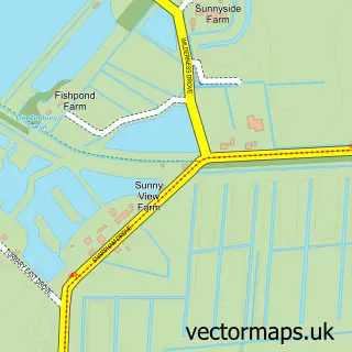
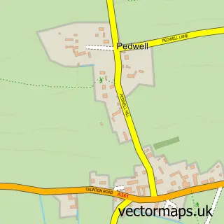
This Walton street map is a detailed vector street map covering a 750m x 750m area. Select a larger area to create and download your own vector street map of Walton.
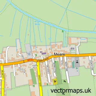
The 750-metre map sample for Walton covers 173 mapped buildings and approximately 9.5 km of road detail, of which 13 named roads are named. The immediate area includes 1 school, 1 GP surgery within 2 miles, 1 pub and 1 MOT station, with 6 within 2 miles. The wider area around Walton features 2 food and drink venues and 1 campsite within 2 miles. To create a larger or custom map of Walton, the map builder lets you define your own coverage area and download editable SVG, PDF and PNG files.
Create a larger editable map of Walton
Choose any area you need and generate a high-quality vector map instantly. Perfect for print, planning, design, business and personal use.

This Walton street map in Somerset is available as downloadable SVG, PDF and PNG map files, or as a printed map for planning, business, display, education, local information and design work. You can also create a larger custom map area using the map selector.
What this Walton map sample shows
Walton lies within Walton Cp parish, part of Moor ward in the Somerset local authority area. The postcode geography for this area includes the BA postcode area, the BA16 postcode district and the BA16 9 postcode sector. Residents fall under the Nhs Somerset Integrated Care Board for NHS services.
Local features near Walton
Within 2 milesAmenities and services in and around Walton.
Administrative and postcode information for Walton
The local authority covering Walton is Somerset, within the county of Somerset. The settlement lies within Moor ward and Walton Cp civil parish. The BA16 postcode district and BA16 9 postcode sector serve the immediate area. NHS provision in the area is delivered through Somerset Nhs Foundation Trust.
Nearby street map samples around Walton

More street maps in Somerset
750 metre map area coverage
Boundary, postcode and point of interest information for the 750m x 750m rectangle centred on this sample map.
Boundaries containing map centre
Constituency: Wells and Mendip Hills Co Const
District: Somerset
Icb: NHS Somerset ICB
Parish: Walton CP
Police Force: avon and somerset
Postcode District: BA16
Postcode Sector: BA16 9
Nearby boundaries intersecting sample
No additional intersecting boundaries found.
Postcode coverage
POI category counts
Building Supply Store: 2
Community Center: 2
Electrician: 2
Preschool: 2
Anglican Church: 1
Coffee Shop: 1
Elementary School: 1
Food Truck: 1
Gardener: 1
Home Service: 1
Sample points of interest
- Walton, Holy Trinity
- Dustbusters house cleaning services
- Old School Carving
- Cafe Jora
- Walton Village Hall
- Walton Village Hall
- AHB Electrical Services
- AHB Electrical services
- Walton Church of England VC Primary School
- Doris - the Vintage Cafe Caravan
- L P Services
- Mandy's Childminding
Create a larger editable map of Walton
This sample shows only a 750 metre area. To create a larger map of Walton, use our map builder to choose your own coverage area, add titles and download editable SVG, PDF and PNG files.
Create a custom map of Walton