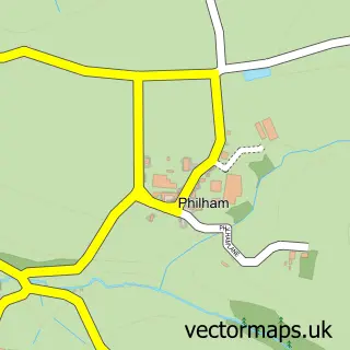
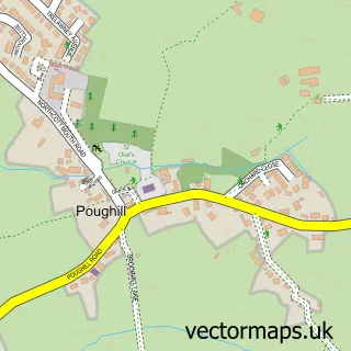
This Welcombe street map is a detailed vector street map covering a 750m x 750m area. Select a larger area to create and download your own vector street map of Welcombe.
The 750-metre map sample for Welcombe covers 44 mapped buildings and approximately 12.1 km of road detail, of which 1 named road are named. The wider area around Welcombe features 1 hotel. To create a larger or custom map of Welcombe, the map builder lets you define your own coverage area and download editable SVG, PDF and PNG files.
Create a larger editable map of Welcombe
Choose any area you need and generate a high-quality vector map instantly. Perfect for print, planning, design, business and personal use.

This Welcombe street map in Devon is available as downloadable SVG, PDF and PNG map files, or as a printed map for planning, business, display, education, local information and design work. You can also create a larger custom map area using the map selector.
What this Welcombe map sample shows
Welcombe lies within Welcombe Cp parish, part of Hartland ward in the Torridge District local authority area. The postcode geography for this area includes the EX postcode area, the EX39 postcode district and the EX39 6 postcode sector. Residents fall under the Nhs Devon Integrated Care Board for NHS services.
Local features near Welcombe
Within 2 milesAmenities and services in and around Welcombe.
Administrative and postcode information for Welcombe
The local authority covering Welcombe is Torridge District, within the county of Devon. The settlement lies within Hartland ward and Welcombe Cp civil parish. The EX39 postcode district and EX39 6 postcode sector serve the immediate area. NHS provision in the area is delivered through Northern Devon Nhs Trust.
Nearby street map samples around Welcombe

More street maps in Devon
750 metre map area coverage
Boundary, postcode and point of interest information for the 750m x 750m rectangle centred on this sample map.
Boundaries containing map centre
Constituency: Torridge and Tavistock Co Const
County: Devon County
District: Torridge District
Icb: NHS Devon ICB
Parish: Welcombe CP
Police Force: devon and cornwall
Postcode District: EX39
Postcode Sector: EX39 6
Ward: Hartland Ward
Nearby boundaries intersecting sample
No additional intersecting boundaries found.
Postcode coverage
POI category counts
Holiday Rental Home: 2
Anglican Church: 1
Beach: 1
Charity Organization: 1
Fashion Accessories Store: 1
Hotel: 1
Sample points of interest
- St Nectan's Church
- Welcombe Mouth
- The Yarner Trust
- CARV
- Down Barton
- Lana Park Holiday Cottages
- Darracott Farm Cottage
Create a larger editable map of Welcombe
This sample shows only a 750 metre area. To create a larger map of Welcombe, use our map builder to choose your own coverage area, add titles and download editable SVG, PDF and PNG files.
Create a custom map of Welcombe