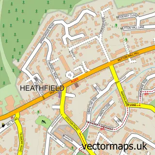
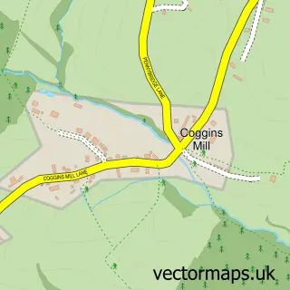
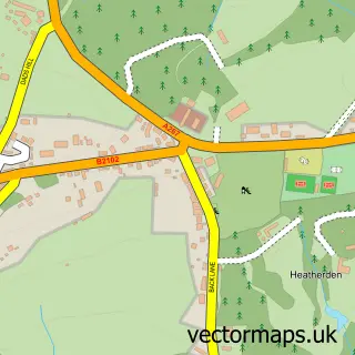
This Wellbrook street map is a detailed vector street map covering a 750m x 750m area. Select a larger area to create and download your own vector street map of Wellbrook.
The 750-metre map sample for Wellbrook covers 157 mapped buildings and approximately 10.5 km of road detail, of which 16 named roads are named. The immediate area includes 1 GP surgery within 2 miles and 1 MOT station, with 2 within 2 miles. To create a larger or custom map of Wellbrook, the map builder lets you define your own coverage area and download editable SVG, PDF and PNG files.
Create a larger editable map of Wellbrook
Choose any area you need and generate a high-quality vector map instantly. Perfect for print, planning, design, business and personal use.

This Wellbrook street map in East Sussex is available as downloadable SVG, PDF and PNG map files, or as a printed map for planning, business, display, education, local information and design work. You can also create a larger custom map area using the map selector.
What this Wellbrook map sample shows
Wellbrook lies within Mayfield And Five Ashes Cp parish, part of Mayfield & Five Ashes ward in the Wealden District local authority area. The postcode geography for this area includes the TN postcode area, the TN20 postcode district and the TN20 6 postcode sector. Residents fall under the Nhs Sussex Integrated Care Board for NHS services.
Local features near Wellbrook
Within 2 milesAmenities and services in and around Wellbrook.
Administrative and postcode information for Wellbrook
Wellbrook lies within Mayfield And Five Ashes Cp parish, part of Mayfield & Five Ashes ward in the Wealden District local authority area. The postcode geography for this area includes the TN postcode area, the TN20 postcode district and the TN20 6 postcode sector. Residents fall under the Nhs Sussex Integrated Care Board for NHS services.
Nearby street map samples around Wellbrook

More street maps in East Sussex
750 metre map area coverage
Boundary, postcode and point of interest information for the 750m x 750m rectangle centred on this sample map.
Boundaries containing map centre
Constituency: Sussex Weald Co Const
County: East Sussex County
District: Wealden District
Icb: NHS Surrey and Sussex ICB
Parish: Mayfield and Five Ashes CP
Police Force: sussex
Postcode District: TN20
Postcode Sector: TN20 6
Ward: Mayfield & Five Ashes Ward
Nearby boundaries intersecting sample
No additional intersecting boundaries found.
Postcode coverage
POI category counts
Liquor Store: 2
Advertising Agency: 1
Arts And Entertainment: 1
Automotive: 1
Automotive Repair: 1
Business: 1
Cricket Ground: 1
Event Photography: 1
Health Market: 1
Installment Loans: 1
Sample points of interest
- London Cartoonists
- Mike Mosedale
- Tune Up
- Wellbrook Motor Services
- Scientific Update
- Mayfield Cricket Club
- Hireacamera
- Healthy Distance Ltd.
- Trythekit
- Las Bodegas
- Wellbrook Wines
- The Joint and Back Clinic
Create a larger editable map of Wellbrook
This sample shows only a 750 metre area. To create a larger map of Wellbrook, use our map builder to choose your own coverage area, add titles and download editable SVG, PDF and PNG files.
Create a custom map of Wellbrook