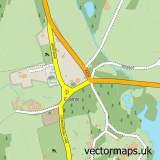
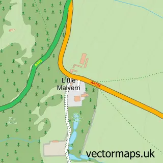
This Wellington Heath street map is a detailed vector street map covering a 750m x 750m area. Select a larger area to create and download your own vector street map of Wellington Heath.
The 750-metre map sample for Wellington Heath covers 175 mapped buildings and approximately 27.1 km of road detail, of which 8 named roads are named. The immediate area includes 1 GP surgery within 2 miles, 1 pub and 3 MOT stations within 2 miles. The wider area around Wellington Heath features 1 food and drink venue. To create a larger or custom map of Wellington Heath, the map builder lets you define your own coverage area and download editable SVG, PDF and PNG files.
Create a larger editable map of Wellington Heath
Choose any area you need and generate a high-quality vector map instantly. Perfect for print, planning, design, business and personal use.

This Wellington Heath street map in Herefordshire is available as downloadable SVG, PDF and PNG map files, or as a printed map for planning, business, display, education, local information and design work. You can also create a larger custom map area using the map selector.
What this Wellington Heath map sample shows
Wellington Heath lies within Wellington Heath Cp parish, part of Ledbury North ward in the County Of Herefordshire local authority area. The postcode geography for this area includes the HR postcode area, the HR8 postcode district and the HR8 1 postcode sector. Residents fall under the Nhs Herefordshire And Worcestershire Integrated Care Board for NHS services.
Local features near Wellington Heath
Within 2 milesAmenities and services in and around Wellington Heath.
Administrative and postcode information for Wellington Heath
The local authority covering Wellington Heath is County Of Herefordshire, within the county of Herefordshire. The settlement lies within Ledbury North ward and Wellington Heath Cp civil parish. The HR8 postcode district and HR8 1 postcode sector serve the immediate area. NHS provision in the area is delivered through Wye Valley Nhs Trust.
Nearby street map samples around Wellington Heath

More street maps in Herefordshire
750 metre map area coverage
Boundary, postcode and point of interest information for the 750m x 750m rectangle centred on this sample map.
Boundaries containing map centre
Constituency: North Herefordshire Co Const
District: County of Herefordshire
Icb: NHS Herefordshire and Worcestershire ICB
Parish: Wellington Heath CP
Police Force: west mercia
Postcode District: HR8
Postcode Sector: HR8 1
Ward: Ledbury North Ward
Nearby boundaries intersecting sample
Parish: Ledbury CP
Postcode coverage
POI category counts
Anglican Church: 1
Building Supply Store: 1
Cottage: 1
Dog Walkers: 1
Equestrian Facility: 1
It Service And Computer Repair: 1
Nutritionist: 1
Packing Supply: 1
Pub: 1
Transportation: 1
Sample points of interest
- Wellington Heath: Christ Church
- Simon Gent
- Hillside Cottage
- Canine Fun Club
- Heartland Eqine Facilitated Learning IEFL
- PPC Computers
- Cameron Nutrition & Allergy Testing
- Phoenix Packaging
- The Farmers Arms
- Ledbury Taxi Service
- Yoga with Alison
Create a larger editable map of Wellington Heath
This sample shows only a 750 metre area. To create a larger map of Wellington Heath, use our map builder to choose your own coverage area, add titles and download editable SVG, PDF and PNG files.
Create a custom map of Wellington Heath