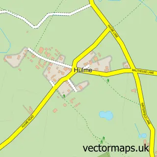
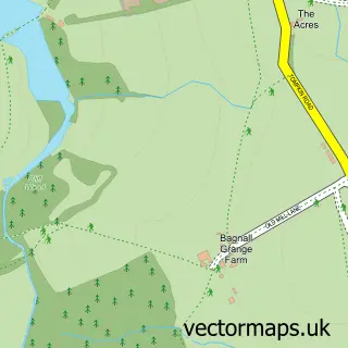
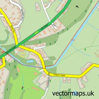
This Werrington street map is a detailed vector street map covering a 750m x 750m area. Select a larger area to create and download your own vector street map of Werrington.
The 750-metre map sample for Werrington covers 443 mapped buildings and approximately 11.9 km of road detail, of which 34 named roads are named. The immediate area includes 1 school, 3 GP surgeries within 2 miles, 2 pubs and 2 MOT stations within 2 miles. The wider area around Werrington features 3 food and drink venues. To create a larger or custom map of Werrington, the map builder lets you define your own coverage area and download editable SVG, PDF and PNG files.
Create a larger editable map of Werrington
Choose any area you need and generate a high-quality vector map instantly. Perfect for print, planning, design, business and personal use.

This Werrington street map in Staffordshire is available as downloadable SVG, PDF and PNG map files, or as a printed map for planning, business, display, education, local information and design work. You can also create a larger custom map area using the map selector.
What this Werrington map sample shows
Werrington lies within Cheddleton Cp parish, part of Cellarhead ward in the Staffordshire Moorlands District local authority area. The postcode geography for this area includes the ST postcode area, the ST9 postcode district and the ST9 0 postcode sector. Residents fall under the Nhs Staffordshire And Stoke-On-Trent Integrated Care Board for NHS services.
Local features near Werrington
Within 2 milesAmenities and services in and around Werrington.
Administrative and postcode information for Werrington
Werrington lies within Cheddleton Cp parish, part of Cellarhead ward in the Staffordshire Moorlands District local authority area. The postcode geography for this area includes the ST postcode area, the ST9 postcode district and the ST9 0 postcode sector. Residents fall under the Nhs Staffordshire And Stoke-On-Trent Integrated Care Board for NHS services.
Nearby street map samples around Werrington

More street maps in Staffordshire
750 metre map area coverage
Boundary, postcode and point of interest information for the 750m x 750m rectangle centred on this sample map.
Boundaries containing map centre
Constituency: Staffordshire Moorlands Co Const
County: Staffordshire County
District: Staffordshire Moorlands District
Icb: NHS Staffordshire and Stoke-on-Trent ICB
Parish: Werrington CP
Police Force: staffordshire
Postcode District: ST9
Postcode Sector: ST9 0
Ward: Cellarhead Ward
Nearby boundaries intersecting sample
Ward: Caverswall Ward, Werrington Ward
Postcode coverage
POI category counts
Beauty Salon: 4
Convenience Store: 2
Flowers And Gifts Shop: 2
Naturopathic Holistic: 2
Pub: 2
Anglican Church: 1
Appliance Manufacturer: 1
Atms: 1
Automotive: 1
Automotive Repair: 1
Sample points of interest
- Werrington St.Philip
- R & M Walsh
- The Cooperative Food Washerwall Lane, Werrington
- DK Mobile Car Mechanic Repair Stoke-on-Trent
- Classic Astons
- Ainsfield Barbershop
- LSP Aesthetics and Beauty
- Margo's Nail & Beauty
- Shine Hair Salon
- Simply Gorgeous
- Roberts Family Butchers
- Little Joe's café
Create a larger editable map of Werrington
This sample shows only a 750 metre area. To create a larger map of Werrington, use our map builder to choose your own coverage area, add titles and download editable SVG, PDF and PNG files.
Create a custom map of Werrington