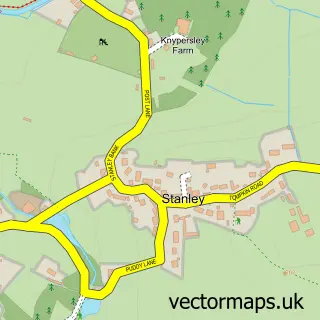
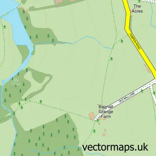
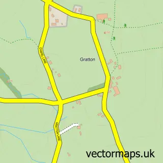
This Stockton Brook street map is a detailed vector street map covering a 750m x 750m area. Select a larger area to create and download your own vector street map of Stockton Brook.
The 750-metre map sample for Stockton Brook covers 155 mapped buildings and approximately 6.8 km of road detail, of which 8 named roads are named. The immediate area includes 3 GP surgeries within 2 miles, 1 pub and 3 MOT stations within 2 miles. The wider area around Stockton Brook features 2 food and drink venues. To create a larger or custom map of Stockton Brook, the map builder lets you define your own coverage area and download editable SVG, PDF and PNG files.
Create a larger editable map of Stockton Brook
Choose any area you need and generate a high-quality vector map instantly. Perfect for print, planning, design, business and personal use.

This Stockton Brook street map in Staffordshire is available as downloadable SVG, PDF and PNG map files, or as a printed map for planning, business, display, education, local information and design work. You can also create a larger custom map area using the map selector.
What this Stockton Brook map sample shows
Stockton Brook lies within Bagnall Cp parish, part of Bagnall And Stanley ward in the Staffordshire Moorlands District local authority area. The postcode geography for this area includes the ST postcode area, the ST9 postcode district and the ST9 9 postcode sector. Residents fall under the Nhs Staffordshire And Stoke-On-Trent Integrated Care Board for NHS services.
Local features near Stockton Brook
Within 2 milesAmenities and services in and around Stockton Brook.
Administrative and postcode information for Stockton Brook
Stockton Brook lies within Bagnall Cp parish, part of Bagnall And Stanley ward in the Staffordshire Moorlands District local authority area. The postcode geography for this area includes the ST postcode area, the ST9 postcode district and the ST9 9 postcode sector. Residents fall under the Nhs Staffordshire And Stoke-On-Trent Integrated Care Board for NHS services.
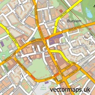
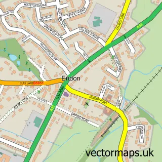
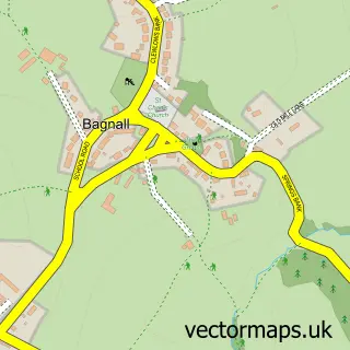
Nearby street map samples around Stockton Brook

More street maps in Staffordshire
750 metre map area coverage
Boundary, postcode and point of interest information for the 750m x 750m rectangle centred on this sample map.
Boundaries containing map centre
Constituency: Staffordshire Moorlands Co Const
County: Staffordshire County
District: Staffordshire Moorlands District
Icb: NHS Staffordshire and Stoke-on-Trent ICB
Parish: Bagnall CP, Endon and Stanley CP
Police Force: staffordshire
Postcode District: ST9
Postcode Sector: ST9 9
Ward: Bagnall and Stanley Ward
Nearby boundaries intersecting sample
Constituency: Stoke-on-Trent North Boro Const
District: City of Stoke-on-Trent (B)
Ward: Baddeley, Milton & Norton Ward
Postcode coverage
POI category counts
Mediterranean Restaurant: 3
Post Office: 2
Preschool: 2
Scout Hall: 2
Appliance Store: 1
Barber: 1
Beauty Salon: 1
Bridal Shop: 1
Contractor: 1
Corporate Entertainment Services: 1
Sample points of interest
- The Kitchen Station
- Alpha Male Barbers. Stockton Brook
- Barebeauty
- Graceful Gowns Bridal Lounge
- Central Driveways
- Abracadabra
- Post Office Travel Money
- Greenway Hall Golf Club
- Clowes & Co Solicitors
- Bentley Marketing Consultancy
- Ego Mediterranean
- Ego at The Hollybush
Create a larger editable map of Stockton Brook
This sample shows only a 750 metre area. To create a larger map of Stockton Brook, use our map builder to choose your own coverage area, add titles and download editable SVG, PDF and PNG files.
Create a custom map of Stockton Brook